About This Route
Route 1 east from Höfn through the East Fjords to Egilsstaðir. Dramatic fjord roads, fishing villages, and optional detour to Jökulsárlón glacier lagoon. WARNING: Single-lane bridges and tunnels are frequent; some fjord roads (Route 95) are narrow and steep.
Detailed Route Guide
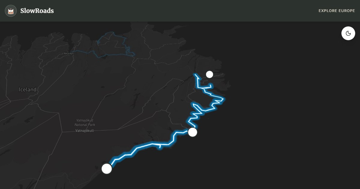
The eastern section of Iceland's Ring Road (Route 1) is the quiet half of the island — less trafficked than the south coast spectacle, but no less extraordinary. From the lobster town of Höfn, the road traces the edge of Vatnajökull, Europe's largest glacier, before turning north into the East Fjords, a labyrinth of deep inlets, fishing villages, and mountain roads that feel genuinely remote even in summer.
The unmissable detour west of Höfn is Jökulsárlón glacier lagoon, where icebergs calve from the Breiðamerkurjökull tongue and drift in milky blue water before washing onto the black sand of Diamond Beach across the road. Boat tours navigate between the ice; photographers arrive before dawn when the light is soft and the crowds absent. Vestrahorn mountain, near Höfn, offers another iconic composition — jagged peaks reflected in tidal pools on black sand.
Heading north, Route 1 climbs through Berufjörður and the long tunnel to Reyðarfjörður, then continues through a series of fjord indentations — each village smaller and more weather-beaten than the last. Seyðisfjörður, reached via the scenic Route 93 over Fjarðarheiði pass, is the artistic heart of the east: a rainbow-painted church, wooden houses in pastel colours, and a ferry connection to Denmark. The fjord road to Seyðisfjörður has eleven hairpin bends and can be fog-bound; drive slowly.
For vintage van drivers, the east is kinder mechanically than the highlands but demands attention to fuel — distances between stations are long, and Egilsstaðir is the main supply hub. Single-lane bridges require yielding to oncoming traffic; Icelandic etiquette is to give way to whoever is closer. Wind and fog are common on fjord roads. Allow two days minimum, with an overnight in Seyðisfjörður or Egilsstaðir. May through September is the practical window; some fjord roads close in winter.
Frequently Asked Questions
Points of Interest
Jökulsárlón Glacier Lagoon
Nature
Icebergs calving from Breiðamerkurjökull into a milky blue lagoon.
Diamond Beach
Nature
Clear ice chunks washed onto black sand — best at sunrise.
Seyðisfjörður
Town
A colourful art-town at the end of a dramatic fjord road with a rainbow-painted church.
Vestrahorn Mountain
Nature
Jagged peaks rising from a black sand shore near Höfn.
Route Highlights
Route Information
* Waze only navigates to the starting point. Use Google Maps for the full scenic route.
Ask Copilot (AI Travel Guide)
Hello! I am your SlowRoads Copilot. I know the Ring Road East: Fjords to Glacier Lagoon intimately. Ask me about scenic viewpoints, local history, hidden culinary gems, or the best camper spots along the way!