About This Route
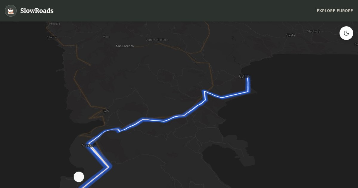
Drive the Mani Peninsula from Gytheio toward Cape Matapan — about 98 km of narrow paved coastal roads for classic and low-power campervans. Tower-house villages, Diros Caves boat tours, Vathia’s abandoned ridge, and deep-blue coves define the Deep Mani. Grades are short but steep near headlands; cool patiently and use pull-outs for oncoming coaches. Organised campsites only — wild camping on beaches and near ruins is illegal and enforced. Shoulder seasons (April–June, September–October) beat August heat and traffic. Fill fuel in Gytheio or Areopoli before quieter southern stretches; leave large vans outside the tightest village cores.
Detailed Route Guide
The Mani Peninsula is one of the last truly wild corners of mainland Greece, a place where Byzantine history and stark natural beauty collide in equal measure. Jutting southward from the Peloponnese like a clenched fist, the Deep Mani (Exo Mani and Mesa Mani) has been shaped by centuries of fierce independence. The region's clan warfare gave rise to its most iconic architectural feature: the tower-house (pyrgospito), built tall so families could rain stones and fire down on their feuding neighbors. Driving south from the port of Gytheio, the landscape shifts almost immediately — olive groves give way to grey limestone slopes, sparse phrygana scrub, and a silence broken only by goat bells. The road winds past fortified villages perched on ridges, offering a quiet immersion into a culture that resisted Ottoman rule for centuries by sheer stubbornness and geographic remoteness.
The highlight of any Mani drive is Cape Matapan (Tainaron), the southernmost point of mainland Greece and the second-southernmost tip of mainland Europe (after Spain's Punta de Tarifa). A short walk from the road's end leads to the ruins of a Temple of Poseidon and a lighthouse. The feeling is appropriately dramatic — two seas collide, hawks circle overhead, and the abandoned tower-villages of Vathia loom behind you on the ridge. Vathia itself is the most photographed village in the Mani: a cluster of stone towers rising from a barren crag, many uninhabited for generations, the whole scene looking like a medieval Manhattan in miniature. The Caves of Diros near Areopoli offer another world entirely — a subterranean labyrinth of stalactite-studded chambers, partly navigated by small rowing boat through flooded passages, one of the great natural wonders of southern Greece.
For classic and low-power campervan drivers, the Mani is a genuine adventure rather than a cruise. The main road (the so-called "coastal road" south of Areopoli) is paved but narrow, and sections near Gerolimenas and around Vathia involve tight stone walls and blind corners that demand patience and attentiveness. The good news is that traffic is remarkably light — outside of the August peak, you may share these roads with nothing but a shepherd moving his flock. The lack of significant sustained gradients (outside of a few short climbs) means an older campervan with modest horsepower is perfectly adequate if brakes and cooling are sound. Wild camping is officially illegal in Greece, though informal overnight parking on flat gravel near the sea is sometimes tolerated in the quieter Mani — stay discreet, leave no trace, and expect stricter enforcement near villages in summer.
The best seasons for driving the Mani are spring (April–May) and autumn (September–October). Spring transforms the otherwise barren hillsides with wildflowers — purple sage, yellow broom, and red poppies — and temperatures hover in the comfortable 18–24°C range. Summer is extremely hot and dry, with midday temperatures regularly exceeding 38°C; plan to drive in the early morning and spend afternoons in the shade or swimming in one of the deep-blue coves. The Mani receives very little rain between June and September, so dust on the minor tracks is a constant companion. In late October and November the sea remains warm enough for swimming, the light turns golden, and the tourist infrastructure (tavernas, small guesthouses) begins to close for winter — a trade-off worth knowing in advance.
Frequently Asked Questions
Points of Interest
Vathia Ghost Village
Town
Abandoned Maniot tower cluster on a barren ridge
Caves of Diros
Nature
Underground lake boat tour through stalactite chambers
Cape Matapan
Nature
Southernmost tip of mainland Greece
Route Highlights
Nearby Scenic Drives
Route Information
Navigation
* Supported by HERE Technologies, headquartered in Amsterdam, Europe. Precise routing through all waypoints.
* Waze only navigates to the starting point. Use Google Maps for the full scenic route.
Offline GPS Navigation
Download the GPX route file to navigate offline using your favorite GPS device or app (Garmin, TomTom, OsmAnd, Gaia GPS).
Ask Copilot (AI Travel Guide)
Hello! I am your SlowRoads Copilot. I know the Mani Peninsula Loop intimately. Ask me about scenic viewpoints, local history, hidden culinary gems, or the best camper spots along the way!