About This Route
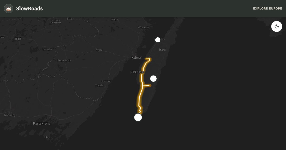
Öland Island loop: free 6 km bridge, UNESCO Stora Alvaret limestone plain, wooden windmills, Solliden gardens, and Långe Jan lighthouse. Exceptionally flat — a stress-free cruise for classic and low-power campervans with Baltic light and sea views on both sides of the island. Use camps; the alvar is fragile — stay on roads. Summer windmills and bird migration seasons add atmosphere. Two days reward empty limestone horizons and harbour evenings after the bridge crossing from Kalmar. Allow extra time for photo pullouts, fuel stops, and cooling breaks in older vans.
Detailed Route Guide
Öland is Sweden's smallest province and one of its most unusual: a long, thin limestone island off the southeast coast, connected to the mainland by the Öland Bridge — at six kilometres, one of the longest bridges in Europe. The island has been inhabited continuously since the Stone Age, and every era has left its mark: Bronze Age burial cairns, Iron Age ring forts, Viking graves, medieval castles, and the iconic wooden windmills that dot the island's spine. It was declared a UNESCO World Heritage Site in 2000, specifically for the ancient human interaction with the Stora Alvaret — a vast, treeless limestone plateau that supports one of Europe's rarest ecosystems, including flowers that bloom nowhere else on Earth.
The Stora Alvaret is the island's defining landscape, and it requires a pause to appreciate properly. The plateau is almost completely flat and appears empty at first glance, but in May and June it blooms with rare orchids, wild thyme, and the delicate pasqueflower. In summer the quality of light here is exceptional — the limestone reflects a silver-white brightness that makes the colours of wildflowers almost supernatural. The lack of trees means the horizon extends in every direction, giving a feeling of immense space despite the island's modest width. At the southern tip, the Långe Jan lighthouse stands guard over a bird migration point where hundreds of thousands of birds pass through each spring and autumn. The observation tower adjacent to the lighthouse is worth climbing for the 360-degree view.
For van travellers, Öland is a dream: the roads are flat, well-surfaced, and almost entirely free of challenging gradients. The main road along the spine of the island is straight and fast, but the real pleasure comes from the network of small lanes on the west coast, where you can drive from windmill to windmill, stopping at farm stalls selling honey, lavender, and island-smoked fish. Near Borgholm, the Swedish royal family's summer residence Solliden opens its gardens to visitors in summer — an unexpectedly charming glimpse into Swedish royal informality. The ruins of Borgholm Castle, gutted by fire in the 18th century, are dramatic enough to rival anything in Scandinavia.
The best time to visit is late May to June for the Alvaret wildflowers, or August to September for warm weather and migrating birds. The island's campgrounds are among Sweden's best — particularly Böda on the north coast, which has extensive pine forests, long sandy beaches, and direct Baltic swimming. Öland is popular with Swedish families in summer, so July brings heavy traffic on the bridge and busy campgrounds. A weekday or shoulder-season visit is much quieter. The island makes a perfect two or three-day pause between longer legs of a Scandinavian van trip.
For classic and low-power campervans the bridge crossing is free and straightforward, though strong autumn winds can briefly restrict high-sided vehicles — check conditions if you arrive in a gale. Stay on paved lanes across the Alvaret; the limestone plain is terrain under Swedish off-road rules, so do not drive onto the open alvar to park. Prefer campsites or legal parking near Mörbylånga and Borgholm, and treat Solliden garden opening dates as seasonal rather than guaranteed. Two days cover the south tip and windmills; three let you add Böda beaches without rushing.
Frequently Asked Questions
Points of Interest
Solliden Palace
Castle
Långe Jan Lighthouse
Nature
Stora Alvaret (Limestone Plain)
Nature
Route Highlights
Route Information
Navigation
* Supported by HERE Technologies, headquartered in Amsterdam, Europe. Precise routing through all waypoints.
* Waze only navigates to the starting point. Use Google Maps for the full scenic route.
Offline GPS Navigation
Download the GPX route file to navigate offline using your favorite GPS device or app (Garmin, TomTom, OsmAnd, Gaia GPS).