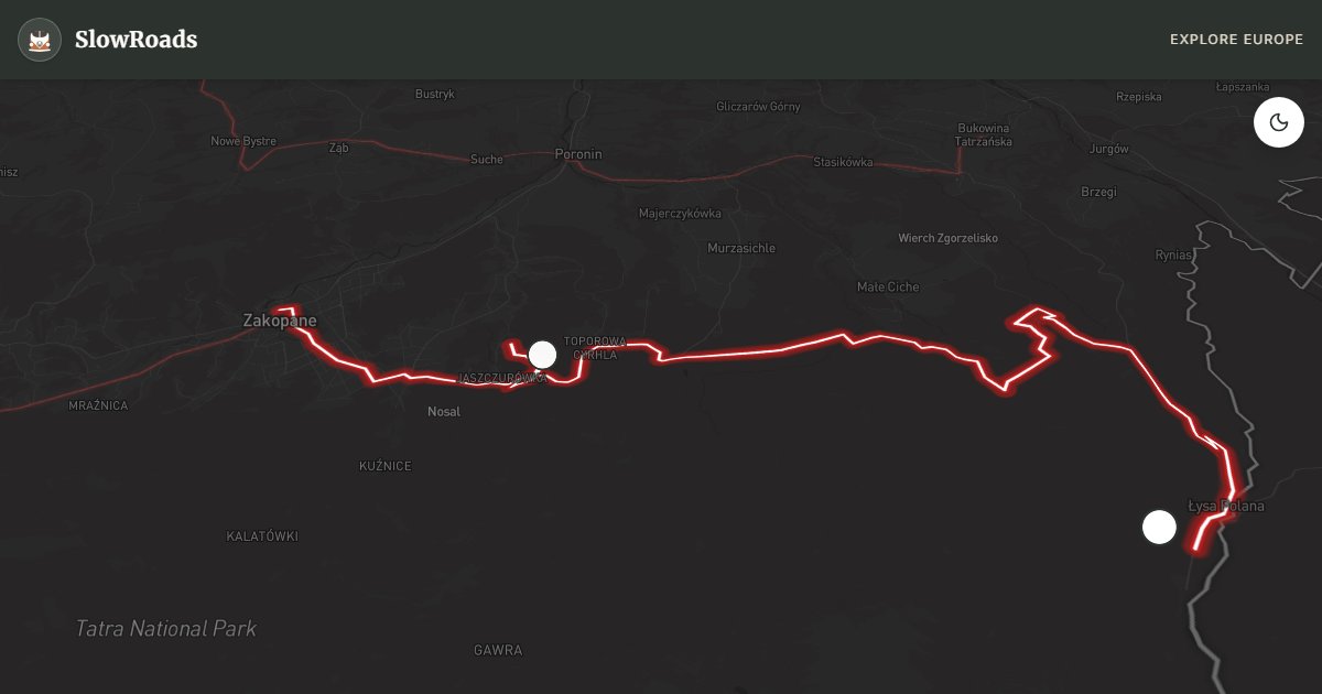
Oswald Balzer Road
About This Route
Climb the Oswald Balzer Road from Zakopane to Palenica Białczańska — about 23 km to the Morskie Oko trailhead for classic campervans. Steady alpine grades need cooling, low gears, and patience in loaded older vans; book Tatra park parking online before you leave. Hike from the trailhead — vehicles stop at Palenica. Campsites in Zakopane valley only; no overnighting at the park gate. May–June and September beat August queues; winter snow demands serious preparation. Fill fuel in Zakopane. Jaszczurówka chapel and Mickiewicz falls reward short stops if traffic allows. Engine-brake the descent — brakes heat fast on this approach.
Detailed Route Guide
The Oswald Balzer Road (Droga Oswalda Balzera) is the classic alpine approach in the Polish High Tatras from Zakopane to Palenica Białczańska, the trailhead for Morskie Oko — the range's most celebrated mountain lake. Named after historian and lawyer Oswald Balzer, the roughly 23-kilometre road follows the northern slopes through spruce forest and across mountain torrents, with granite peaks rising close above the trees. It is short on the map and long in atmosphere: every kilometre trades resort bustle for higher, cooler air.
Early on, the wooden chapel at Jaszczurówka shows Zakopane Style craftsmanship built without iron nails — a worthwhile pull-off before the road commits east. Mountain meadows often host roadside stalls selling smoked oscypek sheep's cheese from Goral shepherds. The final stretch drops toward the Rybi Potok valley and the busy Palenica Białczańska car park. Private vehicles stop here; the remaining about 9 km to Morskie Oko is on foot or by horse-drawn carriage. The lake itself sits in a glacial cirque under walls rising roughly a thousand metres, with Rysy (Poland's highest peak at 2,499 m) in the backdrop. Chamois and marmots inhabit the higher ground; weather can flip from sun to cold rain in an hour.
For older and low-power campervans the challenge is steady climbing rather than a single extreme pass. Zakopane sits around 850 m; Palenica Białczańska is over 1,100 m, with repeated pulls that heat modest engines on warm afternoons. Service the cooling system, drop early into lower gears, and pause if temperatures climb. Zakopane centre access is restricted in peak season — park on the perimeter and walk or bus in before joining the Balzer road. The Palenica car park is reservation-only via Tatra National Park systems and sells out days ahead in July–August; without a booking you may be turned away after the climb.
July and August are the busiest: expect queues, full lots, and crowded trails. May–June and September are kinder for slow campers — cooler climbs, clearer light, fewer day-trippers. Winter brings deep snow and ice; winter tyres are essential and the road can feel serious for vintage brakes. Wild camping is not allowed in the national park; overnight in Zakopane-area campsites or agritourism farms and day-drive to Palenica. Bring layers even in summer for the lake hike, cash or card for park fees, and patience for shared narrow sections with coaches and cyclists.
If you only have one Tatra day, this road plus the lake hike is the highest-reward combination from Zakopane. Start early, confirm the parking code or QR before the final kilometres, and carry water for the walk. Coaches and taxis also use the approach — yield on narrow bends and avoid blocking the carriage lane. After the hike, descend in daylight when possible; evening mist and tourist traffic make the return slower for low-power vans.
Fuel up in Zakopane before the approach; services thin toward Palenica. Keep a paper or offline map backup — mobile signal can drop in the forested valley. If travelling with a tall or long classic camper, watch overhanging branches on the narrower stretches and choose edge parking carefully so you do not block coaches. The reward is one of Poland's most iconic alpine days: granite walls, cold lake water, and a road that still feels like a mountain approach rather than a motorway spur.
Frequently Asked Questions
Points of Interest
Jaszczurówka Chapel
Monument
A masterpiece of the traditional Zakopane wooden architectural style, built without iron nails.
Wodogrzmoty Mickiewicza
Nature
Stunning mountain waterfalls in the Roztoka Valley cascade down deep granite rocks.
Morskie Oko Trailhead
Nature
The Palenica Białczańska trailhead, where vehicles park before the hike to the alpine lake.
Route Highlights
Route Information
Navigation
* Supported by HERE Technologies, headquartered in Amsterdam, Europe. Precise routing through all waypoints.
* Waze only navigates to the starting point. Use Google Maps for the full scenic route.
Offline GPS Navigation
Download the GPX route file to navigate offline using your favorite GPS device or app (Garmin, TomTom, OsmAnd, Gaia GPS).
Ask Copilot (AI Travel Guide)
Hello! I am your SlowRoads Copilot. I know the Oswald Balzer Road intimately. Ask me about scenic viewpoints, local history, hidden culinary gems, or the best camper spots along the way!