About This Route
World Heritage post-glacial uplift landscape — Skuleskogen, Höga Kusten bridge, and coastal villages.
Detailed Route Guide
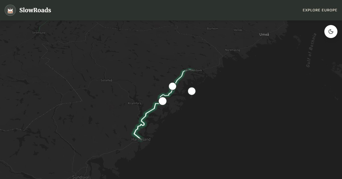
One hundred and twenty kilometres of Sweden's Höga Kusten — the High Coast — trace a UNESCO World Heritage shoreline where the land still rises nearly a centimetre each year as it rebounds from Ice Age ice sheets, turning former seabed into forest and leaving skerries scattered like stepping stones across the Gulf of Bothnia. From Örnsköldsvik south to Härnösand, the route alternates between the fast E4 trunk road and slower coastal detours through fishing villages, granite headlands, and pine forest that smells of resin after rain. For a VW T3, this is manageable Nordic driving: moderate hills on side roads to Skuleberget, long sightlines on the E4, and no mountain passes — though the short climb to the Skule mountain parking area demands second gear and a glance at coolant temperature on warm summer afternoons.
Skuleskogen National Park anchors the route's geological story: trails climb through coastal spruce to Skuleberget, where a cave cuts through the mountain and viewpoints look across a landscape still visibly rising from the sea. The Höga Kusten Bridge — one of Sweden's tallest — spans the Angerman River near Nordingrå with a deck high enough for shipping below and views that justify a stop at the north-side rest area even if you skip the toll-free crossing itself. Ulvöhamn on the Ulvön archipelago delivers red fishing huts, smoked herring from harbour smokehouses, and a ferry mood without leaving the mainland road if time is tight; Trysunda island views from the coast road reward those who take the small car ferry from Köpmanholmen. Allow two full days: Skuleberget hike and bridge viewpoints on day one, Ulvöhamn and the coastal villages toward Härnösand on day two.
Campervan logistics lean on Sweden's allemansrätten — the right of public access — which permits discreet wild camping at least 150 metres from dwellings, though official ställplatser are simpler and safer. Ställplats High Coast near Örnsköldsvik handles services; Skuleberget camping puts you at the trailhead; Ulvöhamn harbour parking suits overnighters who buy dinner from the smokehouse. The E4 carries no toll; island ferries from Köpmanholmen charge per vehicle and run on reduced winter schedules. Fuel and groceries are available in Örnsköldsvik and Härnösand — fill up before Skuleskogen side roads where stations thin out. A T3 fits standard Scandinavian rest-area bays; hold doors on exposed bridge pull-offs when Gulf of Bothnia wind funnels through the Angerman valley.
June brings midnight-sun hikes on Skuleberget when trails stay busy until late evening without headlamps. September paints birch and aspen gold across post-glacial uplift forests and empties the Höga Kusten Bridge viewpoints of convoy traffic. Winter can ice coastal side roads and close Skuleberget access briefly after storms — check Trafikverket before leaving Örnsköldsvik. Midsummer week fills archipelago ferries and harbour parking; book camping or arrive midweek. Two days is the realistic minimum; add a third if you ferry to Ulvön for a full island circuit on foot.
Frequently Asked Questions
Points of Interest
Skuleberget
Nature
Mountain and cave in Skuleskogen NP
Höga Kusten Bridge
Monument
Tall coastal bridge
Ulvöhamn
Town
Island fishing village
Route Highlights
Route Information
* Waze only navigates to the starting point. Use Google Maps for the full scenic route.
Ask Copilot (AI Travel Guide)
Hello! I am your SlowRoads Copilot. I know the High Coast UNESCO Route intimately. Ask me about scenic viewpoints, local history, hidden culinary gems, or the best camper spots along the way!