About This Route
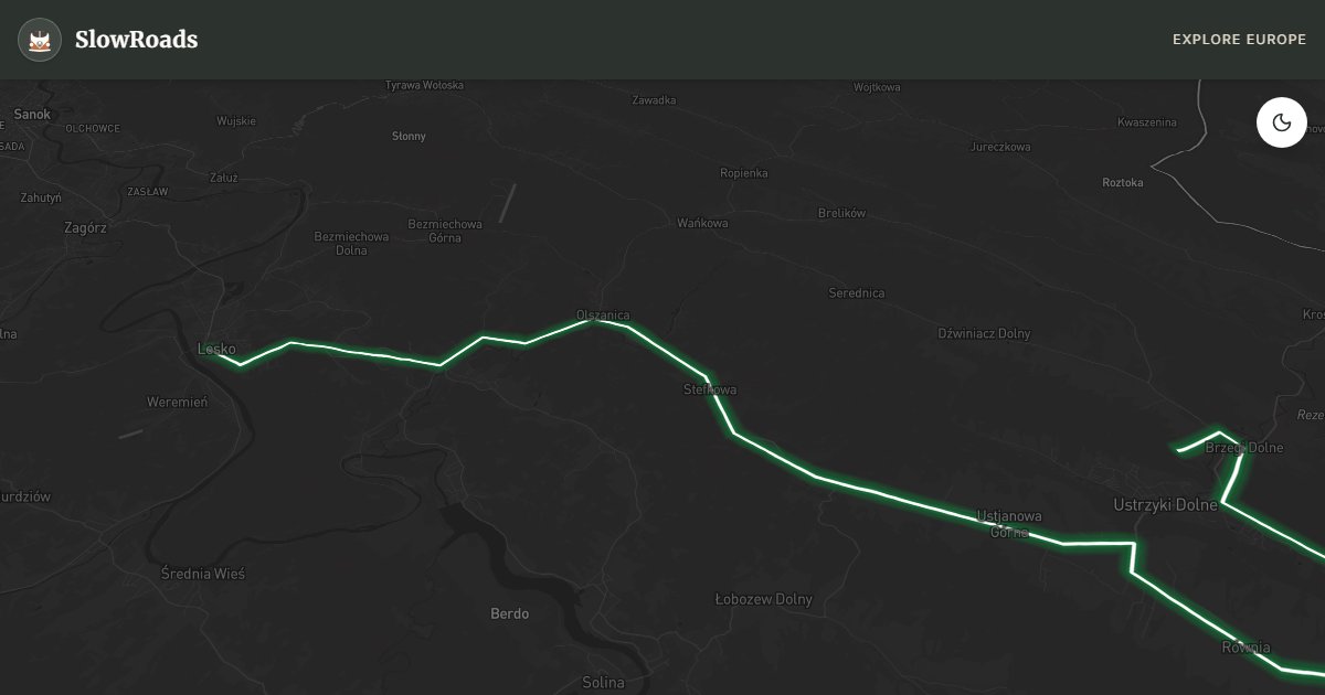
Drive Poland’s wildest loop through the Bieszczady — about 119 km of forests, połoniny meadows, and empty Boyko valleys for patient low-power campervans. Narrow climbs, sparse fuel, and solitude define the far southeast; cool early and carry reserves. Hike to Połonina Wetlińska viewpoints; leave the van in marked lots. Campsites and agroturystyka only — park rules ban overnighting on forest tracks. May–June and September beat midges and peak hikers; winter snow demands serious tyres. Fill fuel in Lesko or Ustrzyki Dolne before remote stretches. Classic-camper pace matches this empty borderland better than haste.
Detailed Route Guide
The Bieszczady mountains in Poland's far southeastern corner are the country's wildest, most remote, and most hauntingly beautiful landscape — a place where the borderlands of Poland, Ukraine, and Slovakia converge in a sweep of ancient forest, high rolling sub-alpine meadows (połoniny), and valleys that were emptied of their entire population in one of 20th-century Europe's most tragic acts of ethnic cleansing. Between 1944 and 1947, the Lemko and Boyko peoples — Ruthenian-speaking communities who had lived in these mountains for centuries — were forcibly displaced from their villages in Operation Vistula, a Soviet-backed resettlement programme. Today, the apple trees they planted still bloom each May among the ruins of their churches, the grassed-over foundations of their houses barely visible in the undergrowth. The Bieszczady has never been resettled; it returned entirely to forest and is now one of the greatest wildlife sanctuaries in Central Europe, home to Eurasian brown bears, grey wolves, Eurasian lynx, and European bison.
The Bieszczady National Park covers 292 km² and this 119-kilometre loop encircles it, beginning and ending at the gateway towns of Lesko and Ustrzyki Dolne. The route passes through or near the villages of Cisna, Wetlina, and Lutowiska — tiny settlements that are the only human communities in the heart of the park area. The połoniny (high mountain meadows above the treeline) are the landscape highlight: vast, treeless ridges of grass and blueberry scrub that in good visibility offer views extending into Ukraine and Slovakia. The most accessible połoniny for a van-based visitor is Połonina Wetlińska (1,255m), reached by a 2-hour hike from the village of Wetlina. Nearby, Lake Solina — a vast reservoir created in the 1960s by damming the San river — offers 160km of wild shoreline with numerous secluded bays, and its concrete arch dam is open for a spectacular walk-across.
For older and low-power campervans the Bieszczady is challenging and rewarding. Park roads are well-surfaced but narrow and winding, with sustained 8–10% climbs — notably around Przełęcz Wyżniańska and between Cisna and Wetlina. Carry coolant, climb slowly, and never overtake on blind bends; logging trucks appear suddenly. Low traffic outside summer weekends is the compensation — you may drive half an hour alone. Fuel in Lesko, Cisna, and Ustrzyki Dolne; do not count on tiny villages between.
The Bieszczady is exceptional in May–June when the forest is in full spring growth and the wildflowers on the połoniny are at their peak. July and August bring the most reliable weather and the longest days, making it the most practical season for hiking to the high meadows. September is a gem: the blueberries ripen on the ridges, the first autumn colours appear, and the bear population is actively foraging before hibernation (your best chance of a dawn wildlife sighting). October has spectacular foliage but some facilities close. Winter is for serious adventurers only — the roads can be closed by snowfall, and temperatures regularly drop below -15°C. Whichever season you choose, the Bieszczady rewards slow travel more than almost anywhere else in Europe.
Frequently Asked Questions
Points of Interest
Połonina Wetlińska (Viewpoint)
Nature
A high-altitude mountain meadow offering views into Ukraine and Slovakia. A hike is mandatory to see the sunset here.
Lake Solina (nearby)
Nature
Poland's largest artificial lake with 160km of wild shoreline and massive concrete dam open to visitors.
Route Highlights
Route Information
Navigation
* Supported by HERE Technologies, headquartered in Amsterdam, Europe. Precise routing through all waypoints.
* Waze only navigates to the starting point. Use Google Maps for the full scenic route.
Offline GPS Navigation
Download the GPX route file to navigate offline using your favorite GPS device or app (Garmin, TomTom, OsmAnd, Gaia GPS).
Ask Copilot (AI Travel Guide)
Hello! I am your SlowRoads Copilot. I know the Wild Bieszczady Loop intimately. Ask me about scenic viewpoints, local history, hidden culinary gems, or the best camper spots along the way!