About This Route
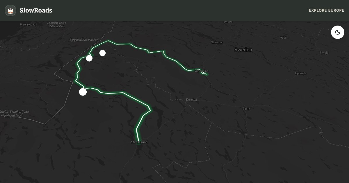
Sweden's Wilderness Road: about 359 km from Strömsund to Vilhelmina over Stekenjokk (876 m, highest paved road). Reindeer, Hällingsåfallet waterfall, and open fell country — typically open early June to mid-October. The long climb is manageable for classic and low-power campervans with fuel stops, cooling pauses, and weather checks. Services thin on the plateau; carry supplies. A true north SlowRoads stage where distance and wind matter more than hairpins. Prepare cooling and fuel before committing to the high section. Allow extra time for photo pullouts, fuel stops, and cooling breaks in older vans.
Detailed Route Guide
The Vildmarksvägen — the Wilderness Road — is Sweden's answer to the great wilderness drives of North America. At 359 kilometres from Strömsund to Vilhelmina, it is not a single dramatic pass but a sustained immersion in northern Scandinavia's emptiest landscapes. You will drive through primeval boreal forest, cross the bare fell landscape of the Stekenjokk plateau (the highest paved road in Sweden at 876 metres), and pass through Sami communities where reindeer still outnumber people. The word 'remote' is not a marketing phrase here — it is a practical reality. Mobile phone coverage disappears for long stretches, the villages are dozens of kilometres apart, and the closest thing to a traffic jam is a herd of reindeer deciding to cross the road at their own pace.
The centrepiece of the route is the Stekenjokk plateau. The ascent is long and steady rather than steep, winding up through birch scrub before the trees thin out entirely and the landscape opens to a vast, windswept highland. In the brief Arctic summer, the plateau erupts with wildflowers and migratory birds. The descent to the west — the most dramatic section of the road — drops sharply through a series of switchbacks into the Vojmsjön lake system, with views that stretch for tens of kilometres. Near Klimpfjäll, Hällingsåfallet waterfall plunges in a dramatic double drop that justifies the short walk from the roadside. In the forests around Ankarede, you may find the tiny church village where Sami families from a vast region once gathered for important services — the wooden church and log storehouses are a window into a culture that has quietly persisted for millennia.
For a classic or low-power campervan, the Vildmarksvägen is achievable but demands thorough preparation. The gradient on Stekenjokk is sustained but not brutal — the main concern is the sheer remoteness. Carry spare fuel, because petrol stations are far apart and some close early. Carry enough food and water for two days in case of a breakdown. The road is paved throughout but some sections have coarse, frost-damaged asphalt that can feel rough. The key danger for older, low-power vans is the possibility of overheating on the Stekenjokk ascent — monitor your temperature gauge and have the same strategy as on any mountain road (slow down, use lower gears, stop and idle if needed). In good summer conditions, the road is completely manageable at a measured pace.
The road is only fully open from approximately June to mid-October. The Stekenjokk plateau section in particular remains snowbound long into spring and can receive snow as early as September. Check conditions with the Swedish Transport Administration before departure. The ideal window is July to mid-August — the days are extraordinarily long, the plateau flowers are in bloom, and the light at midnight is an otherworldly experience. Midges (knott) are an unavoidable reality from late June to early August: bring insect repellent of the most serious variety. Autumn, when the birch trees turn gold and the reindeer herds are driven down from the high ground, offers the best photography but shortening days.
Frequently Asked Questions
Points of Interest
Hällingsåfallet Waterfall
Nature
Stekenjokk Plateau
Nature
Ankarede Church Village
Town
Route Highlights
Route Information
Navigation
* Supported by HERE Technologies, headquartered in Amsterdam, Europe. Precise routing through all waypoints.
* Waze only navigates to the starting point. Use Google Maps for the full scenic route.
Offline GPS Navigation
Download the GPX route file to navigate offline using your favorite GPS device or app (Garmin, TomTom, OsmAnd, Gaia GPS).