About This Route
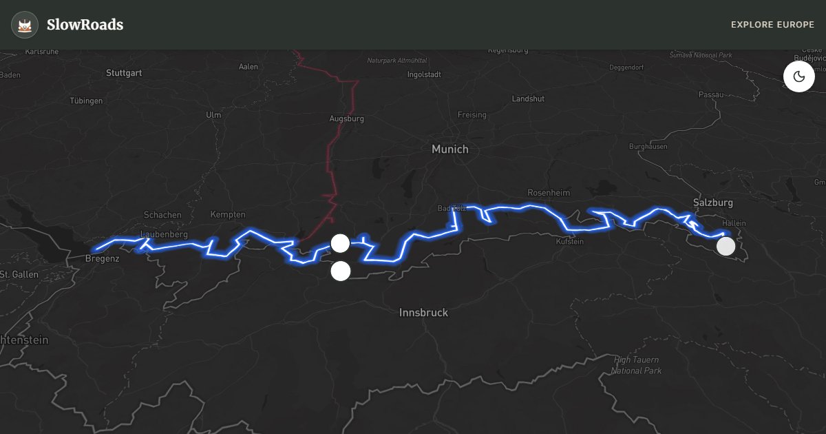
Drive the German Alpine Road from Lindau on Lake Constance to Königssee: Allgäu meadows, Neuschwanstein, Zugspitze views, and Bavarian lakes across about 437 km. Steep sections such as the Oberjoch (over 7%) and Rossfeld demand low gears, cooling stops, and patience in a loaded classic campervan. High stretches can stay snowy into late April — aim for late spring through early autumn. Use Stellplätze and valley campgrounds rather than wild overnighting; check coolant and brakes before climbs, and engine-brake on descents. The reward is Germany’s finest alpine panorama at a slow-travel pace.
Detailed Route Guide
The German Alpine Road is the country's most ambitious mountain drive, spanning 437 kilometres along the northern edge of the Alps from Lindau on Lake Constance to the Königssee near Berchtesgaden. Opened in stages between 1928 and 1954 and designed as a showcase for the Bavarian Alps, it connects lakes, passes, royal palaces, and traditional villages in a journey that feels both epic and deeply rooted in Bavarian culture. Unlike the dramatic passes of Austria or Switzerland, much of the route stays below the treeline, giving it an accessible quality — though several sections will genuinely test any slow engine.
The route begins at Lindau, a small island town on Lake Constance whose harbour lighthouse and medieval old town deserve a half-day before heading east. The road immediately begins climbing through the Allgäu Alps — a landscape of green meadows, dairy farms, and the kind of rolling mountain scenery you see on Bavarian beer steins. The cheese produced in the Allgäu (Allgäuer Bergkäse and Emmentaler) is among Germany's finest, and roadside farm shops offer an early detour for provisions. The Oberjoch Pass (1,178m) is the first serious test: a continuous climb on a road with 106 bends (including nine sharp switchbacks) that will bring your coolant temperature needle up and require first gear on the steepest sections. Check your coolant level and allow your engine to cool at the summit before descending.
From Füssen — gateway to the royal castles of Neuschwanstein and Hohenschwangau — the road continues through the Ammergau Alps. The Wieskirche at Steingaden, a UNESCO World Heritage rococo pilgrimage church set incongruously in a green meadow, is a stop of genuine wonder: the interior gilded stucco and frescoes are an argument for baroque excess. Linderhof Palace, the most intimate of King Ludwig II's three castles, sits in the Graswangtal valley surrounded by formal French gardens. Garmisch-Partenkirchen, host of the 1936 Winter Olympics, marks the route's midpoint and the nearest access to Germany's highest peak, the Zugspitze (2,962m), via rack railway.
The eastern half of the route passes through the Chiemgau Alps, with the Chiemsee (Bavaria's largest lake, home to Ludwig II's Herrenchiemsee Palace on an island) and the Tegernsee — a lake beloved of Munich's wealthy and surrounded by restaurants serving the local Tegernseer beer. The route ends at the Königssee, a glacially carved lake whose sheer walls drop directly into the water. Electric ferries (the only motorised boats permitted on the lake) glide silently to the St. Bartholomä chapel, a red-onion-domed baroque church on a peninsula that has become one of the most-photographed spots in Germany.
For classic and low-power campervan drivers: plan carefully. The Oberjoch is steep but manageable if your cooling system is sound. Some sections of the Alpine Road near Berchtesgaden involve gradients above 10%. Carry extra water for the radiator, have the brakes checked before departure, and use engine braking on descents. The reward — 437km of the most varied alpine scenery in Germany — is entirely worth the preparation. Late May through September is the reliable window; shoulder weeks in June and September give clearer air and thinner queues at Neuschwanstein and Königssee.
Best seasons are late spring through early autumn. June brings alpine meadows in flower and snow still clinging to the highest ridges; September offers golden light across the Allgäu and quieter lakeside Stellplätze. Winter closures and ice make the high sections unsuitable for older campers without winter kit — treat the Alpine Road as a fair-weather mountain drive.
Frequently Asked Questions
Points of Interest
Zugspitze
Nature
Linderhof Palace
Castle
Lake Königssee
Nature
Route Highlights
Route Information
Navigation
⚠️ Google Maps has a 10-stop limit. Route is simplified and might bypass some scenic sections.
* Supported by HERE Technologies, headquartered in Amsterdam, Europe. Precise routing through all waypoints.
* Waze only navigates to the starting point. Use Google Maps for the full scenic route.
Offline GPS Navigation
Download the GPX route file to navigate offline using your favorite GPS device or app (Garmin, TomTom, OsmAnd, Gaia GPS).
Ask Copilot (AI Travel Guide)
Hello! I am your SlowRoads Copilot. I know the German Alpine Road intimately. Ask me about scenic viewpoints, local history, hidden culinary gems, or the best camper spots along the way!