About This Route
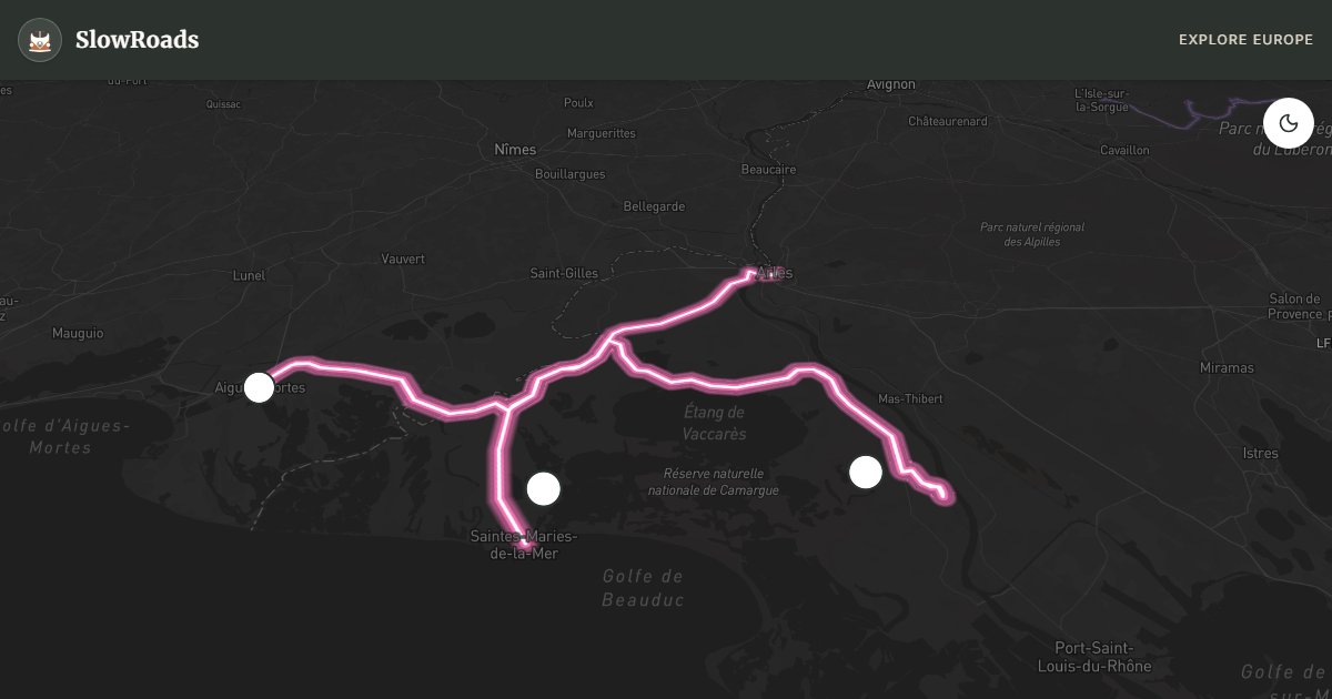
Explore the Camargue delta from Arles toward Saintes-Maries-de-la-Mer: flat marsh roads, pink salt pans, white horses, black bulls and flamingo lagoons. Zero elevation suits classic campervans; wild camping is restricted in the Réserve Nationale — use aires and campgrounds. Don't miss Aigues-Mortes' intact ramparts and Pont de Gau for birds. April–June peak for nesting flamingos; summer brings heat, Mistral wind and mosquitoes — pack repellent. One to two slow days cover the D570, Salin-de-Giraud pans and the medieval salt-town skyline.
Detailed Route Guide
The Camargue is a place apart: a 930-square-kilometre river delta where the Rhône splits into two arms before meeting the Mediterranean, creating a flat, wind-scoured landscape of lagoons, marshes, rice paddies, and salt pans that feels fundamentally different from any other part of France — and, in truth, from most of Europe. The 160-kilometre route from Arles to Saintes-Maries-de-la-Mer and back through the delta rewards unhurried exploration with sightings of wild horses, black bulls, flamingos, and over 400 recorded bird species, all against the backdrop of vast horizons and light that changes constantly with the movement of clouds across the flat land.
The Camargue's most famous residents are the Camargue horses: small, white (they are born dark and whiten with age), semi-wild animals that have lived in the delta for centuries, managed in loose herds by the gardians — the Camargue cowboys who ride them in the traditional style inherited from Roman pastoral practices. You will see herds standing in the shallow lagoons and marshes from the road, particularly on the D36B between Arles and Saintes-Maries. The black bulls (Camargue bulls) are the other large animal emblem of the delta — a breed kept for the traditional southern French sport of course camarguaise (bloodless bull games in which raseteurs on foot snatch ribbons and tassels from the bull's horns) and for meat. You'll see herds standing motionless in the sun along roadside pastures throughout the delta.
The flamingos (flamants roses) are the most spectacular spectacle: colonies of several thousand birds use the Étang de Vaccarès (the largest lagoon in the Camargue, protected as a nature reserve) and the saline pans of Salin-de-Giraud as feeding and nesting grounds. The pink colour comes from carotenoid pigments in the brine shrimps and algae they filter-feed on — they literally become what they eat. The best viewing point is the Ornithological Park (Parc Ornithologique de Pont de Gau) near Saintes-Maries, which has a trail system through the lagoon edge and offers guaranteed flamingo viewing along with herons, egrets, glossy ibis, and seasonal migrants.
Aigues-Mortes is the historical anchor of the route: a perfectly preserved 13th-century fortified city built by Louis IX (Saint Louis) as the departure point for his Crusades to the Holy Land, surrounded by completely intact rampart walls and towers in the flat landscape of the salt pans. From the top of the Tour de Constance, the salt pans of Camargue and the distant sea shimmer in every direction. The town centre, entered through the Porte de la Gardette, has a medieval street plan with a main street leading to a central square with a statue of Saint Louis — a time capsule of Capetian France.
The salt pans of Salin-de-Giraud, near the eastern Rhône arm, are the industrial core of the Camargue: pink and red salt mountains (the colour from the red algae in the brine), harvested mechanically each autumn, with a museum explaining the salt production process and viewpoints over the geometric grid of evaporation pans. The Grande Motte, a resort town to the west designed entirely by architect Jean Balladur in the 1960s with ziggurat-style pyramid buildings, offers an architectural curiosity for those who drive the western edge of the delta.
For van drivers: the Camargue is exceptional — completely flat, good roads, and a landscape that rewards going very slowly. The main roads (D570 to Saintes-Maries, D36B south) are suitable for all vehicles. Some minor tracks through the nature reserve require high clearance. Camping in Saintes-Maries-de-la-Mer and the area around Aigues-Mortes. Wild camping is restricted across much of the Camargue (Réserve Nationale de Camargue) — use official campgrounds and aires instead.
Frequently Asked Questions
Points of Interest
Aigues-Mortes Ramparts
Castle
Ornithological Park (Flamingos)
Nature
Pink Salt Lakes
Nature
Route Highlights
Route Information
Navigation
* Supported by HERE Technologies, headquartered in Amsterdam, Europe. Precise routing through all waypoints.
* Waze only navigates to the starting point. Use Google Maps for the full scenic route.
Offline GPS Navigation
Download the GPX route file to navigate offline using your favorite GPS device or app (Garmin, TomTom, OsmAnd, Gaia GPS).
Ask Copilot (AI Travel Guide)
Hello! I am your SlowRoads Copilot. I know the Camargue Delta Route intimately. Ask me about scenic viewpoints, local history, hidden culinary gems, or the best camper spots along the way!