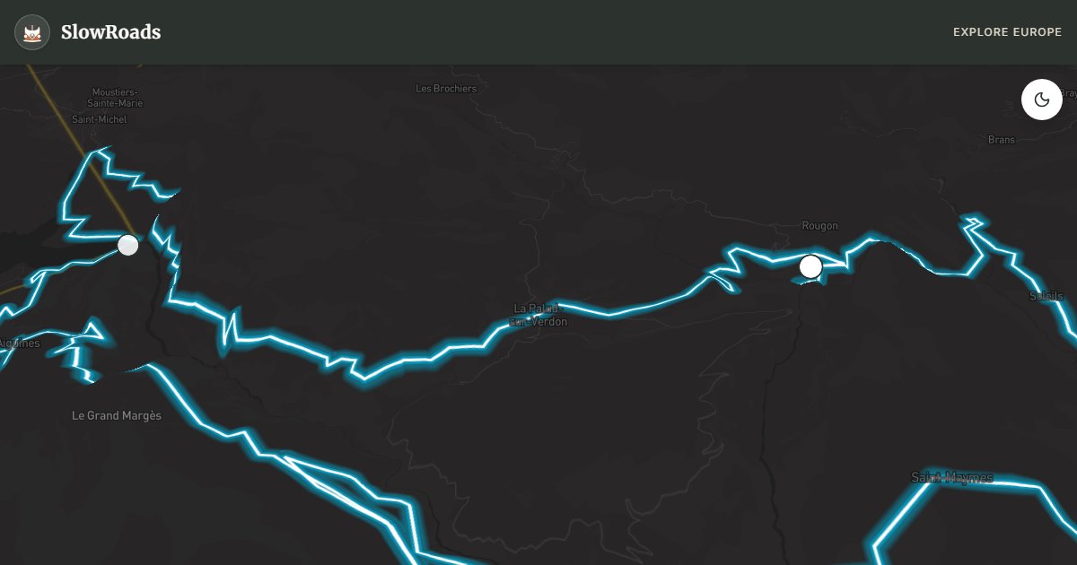
Verdon Gorges - Ridge Road
About This Route
Loop the Route des Crêtes (D23) above the Verdon Gorges — Europe's turquoise limestone canyon near La Palud-sur-Verdon. Narrow rim road, sheer drops and a seasonal one-way section demand focus in a classic campervan; Point Sublime and Escalès belvederes repay the care. Best as a slow day trip from Castellane or Moustiers-Sainte-Marie; avoid peak midday in July–August when coaches clog the rim. Drive clockwise as signed; the Jas d'Aire–La Maline one-way typically closes late November to late March. Griffon vultures soar on thermals — bring binoculars and keep speeds low on exposed ledges.
Detailed Route Guide
The Verdon Gorge is Europe's answer to the Grand Canyon: a 25-kilometre canyon cut by the Verdon river through the limestone Préalpes de Haute Provence, reaching depths of 700 metres and containing water of an extraordinary turquoise-green colour produced by suspended mineral particles from the limestone bedrock. The Route des Crêtes (D23) is a 87-kilometre loop along the southern rim of the gorge from La Palud-sur-Verdon, and it stands as one of the most dramatic short drives in Europe — suitable for a day trip but memorable enough to anchor a full slow travel itinerary around.
The Route des Crêtes was originally constructed in the early 20th century as a military observation road — the canyon walls provide natural defensive terrain — and its width reflects this history: in places the road is barely wide enough for two small vehicles to pass, with a vertical drop of hundreds of metres on the canyon side and the bare limestone cliff face on the other. A central section (Jas d'Aire to La Maline) is one-way; drive the loop clockwise as signed from La Palud (that section typically closes from late November to late March). The road surface is maintained but the experience is unmistakably one of genuine exposure.
The viewpoints (belvédères) along the route are the primary attraction: Maugué, Tilleul, Bau de la Croix, Belvédère de l'Escalès — each offering a different angle on the gorge's colour and depth. The Escalès viewpoint is particularly vertiginous, with the road running along a narrow ledge above a sheer drop to the river. Point Sublime, at the eastern end of the gorge, offers the iconic view over the entire canyon system from a promontory of bare white limestone. Bring binoculars — griffon vultures were reintroduced to the gorge in the 1990s and now soar in large groups on the thermal currents above the canyon.
Below the rim road, the river itself offers a completely different experience: kayaking, canyoning, and white-water paddling operations run from Castellane and Moustiers-Sainte-Marie (the two main base towns) throughout the summer season. From above, the river is an abstract ribbon of turquoise; from below, it's cold, fast, and enclosed between walls that block the sun for most of the day. The contrast between the grandeur seen from the Route des Crêtes and the enclosed intimacy of the gorge floor is one of the Verdon's defining qualities.
Moustiers-Sainte-Marie, on the western approach to the gorge, is worth a stop in its own right: a cliff-hanging village famous for its faïence pottery (tin-glazed earthenware) since the 17th century, with a waterfall bisecting the village centre and a chapel on the cliff above. A golden star suspended between the two cliff faces on a chain — according to legend, placed there by a returning Crusader knight — adds an element of magical realism to the setting.
For van drivers: the Route des Crêtes demands care but is entirely achievable in a classic campervan or similar van. Key considerations: check the one-way direction before setting out; maintain very low speed on the narrow cliff sections; do not attempt to pass other vehicles on the vertiginous rim sections — one of you will need to reverse to a wider point; park at La Palud and walk the belvédère trails if the driving demands are unwanted. The gorge is most beautiful in morning light (east-facing walls catch the early sun) or late afternoon. Avoid midday in July/August when the road is busiest.
Frequently Asked Questions
Points of Interest
Point Sublime
Nature
Galetas Bridge (Lake View)
Nature
Route Highlights
Route Information
Navigation
* Supported by HERE Technologies, headquartered in Amsterdam, Europe. Precise routing through all waypoints.
* Waze only navigates to the starting point. Use Google Maps for the full scenic route.
Offline GPS Navigation
Download the GPX route file to navigate offline using your favorite GPS device or app (Garmin, TomTom, OsmAnd, Gaia GPS).