About This Route
A mountain crossing between two ancient lakes — from Ohrid's eastern shore over Galičica ridge to Lake Prespa's pelican wetlands and Oteshevo views. Paved R1302 with 7% grades and Albania/Greece border panoramas. WARNING: Ridge road exposed to wind; no fuel on the pass.
Detailed Route Guide
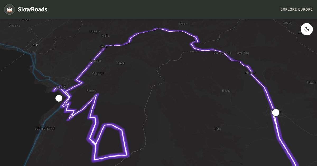
Galičica National Park occupies the mountain ridge between Lake Ohrid and Lake Prespa — two of Europe's oldest lakes separated by just five kilometres of limestone peaks that rise to over 2,000 metres and shelter bears, wolves, and Balkan lynx in forests largely untouched since the park's designation. This roughly 65-kilometre crossing from Ohrid over the Galičica pass to Resen on Prespa's northern shore is North Macedonia's most spectacular short mountain drive: a paved road where both lakes appear in a single panoramic glance, Albania's mountains frame the western horizon, and Greek territory lies visible across Prespa's silver water.
The route begins in Ohrid after you have explored the old town — consider the short climb to St. Gjorgi church on Gorica hill for a farewell view over the lake before heading east on local roads toward Velestovo village and the park entrance. The ascent on R1302 (also signed as the Galičica transversal) gains elevation through mixed oak and beech forest, opening gradually onto alpine pasture where sheep herders maintain summer katuns as they have for centuries. The gradient reaches 7% on the final approach to the ridge — manageable for T3 vans in second gear, but exposed to crosswinds that can push high-sided vehicles on the summit section.
The dual-lake viewpoint near the pass is the route's climax. On clear days — most common in May, June, and September — Ohrid's deep blue spreads westward while Prespa's shallower silver basin opens east toward Greece, with the triple border region of Macedonia, Albania, and Greece visible from a single pullout. Pause here; this is one of the Balkans' great natural theatre moments. Descend the eastern flank through changing vegetation — drier, more open landscape as Prespa's basin captures rain shadow — toward Oteshevo village on the lakeshore.
Prespa feels like Ohrid's quieter sibling. Tourist development is minimal, pelican colonies nest in reedbeds (best viewed from respectful distance with binoculars), and the water supports a cross-border biosphere reserve spanning three countries. Oteshevo offers fish restaurants, a small beach, and guesthouse parking; Resen at the north end provides fuel and supplies before you continue to Bitola or loop back to Ohrid via the southern shore. The return via the full Prespa circuit adds 40 kilometres but rewards with Golem Grad island nature reserve — a snake-free island (rare in Macedonia) with medieval ruins.
Resen's apple orchards define the northern Prespa shore — the plateau climate produces crisp apples sold from roadside stalls throughout autumn, and the town's small museum documents the region's multi-ethnic history including Aromanian shepherd communities who still graze flocks on Galičica's upper slopes. Golem Grad island, reachable by boat from Konjsko village, holds medieval ruins and exceptional birdlife on a predator-free island where snakes were historically absent — a rarity in Macedonia that makes the short boat trip worthwhile for naturalists.
Hiking options abound for travellers who park the van and walk. Marked trails from the pass summit descend to both lake shores; the Galičica transversal trail crosses the full ridge for experienced hikers with a full day to spare. Mountain biking on the pass road is popular with local clubs on summer mornings — share the road carefully on blind corners. The park's visitor centre near Ohrid's Velestovo entrance provides trail maps and current bear activity advisories.
For slow van travellers, Galičica is a one-day crossing or two-day itinerary with an Oteshevo overnight. Fill fuel in Ohrid or Resen — nothing on the pass. Summer afternoons bring local traffic to the beaches; morning crossings offer emptier roads and better light for photography. Winter can close the ridge with snow above 1,400 metres. Pair with the Lake Ohrid loop for a complete lakes week, or continue east to Pelister and Bitola for mountain-to-mountain continuity across western Macedonia.
Frequently Asked Questions
Points of Interest
Galičica Summit Viewpoint
Nature
A ridge pullout where both Lake Ohrid and Lake Prespa are visible simultaneously — rare dual-lake panorama.
Lake Prespa Shore
Nature
A quieter lake shared with Greece and Albania — pelican colonies and reedbed birdwatching.
Oteshevo Resort
Town
A lakeside village with beaches, fish restaurants, and views to Greek Prespa islands.
St. Gjorgi Church on Gorica
Monument
A cliffside chapel above Ohrid old town — short hike reward before the mountain crossing.
Resen Apple Country
Town
A plateau town at the Prespa north shore — apple orchards, fuel, and the Golem Grad island trailhead.
Route Highlights
Route Information
* Waze only navigates to the starting point. Use Google Maps for the full scenic route.
Ask Copilot (AI Travel Guide)
Hello! I am your SlowRoads Copilot. I know the Galičica National Park Crossing intimately. Ask me about scenic viewpoints, local history, hidden culinary gems, or the best camper spots along the way!