About This Route
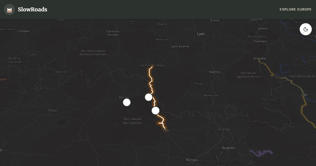
Follow the GR70 Chemin de Stevenson by road from Le Puy-en-Velay toward Alès: chestnut ridges, Mont Lozère, Camisard history and fortified La Garde-Guérin. Rolling to steep D-roads suit a prepared classic campervan — cool on climbs, engine-brake on descents, short stages. Allow 3–4 days; fuel and supplies thin on the high plateau. Wild camping is restricted in Cévennes National Park — use village aires and campgrounds. May–June and September offer open roads without summer storm heat; Robert Louis Stevenson's Travels with a Donkey still maps the spirit of the ridges.
Detailed Route Guide
The Cévennes Stevenson road from Le Puy-en-Velay to Alès follows roughly a hundred and fifty kilometres of the modern GR70 Chemin de Stevenson — an extension of the trek Robert Louis Stevenson made with his donkey Modestine in 1878 (he walked from Le Monastier to Saint-Jean-du-Gard; today's waymarked route adds Le Puy at the start and Alès at the end). Chestnut forests, Protestant Camisard history, and ridge roads climb to Mont Lozère, the highest summit in the Cévennes massif. Published as "Travels with a Donkey," Stevenson's account mapped a landscape of granite ridges and hidden valleys that still feels remote despite its proximity to the Rhône valley. This is steep driving: the D906 and smaller mountain roads demand second gear, engine braking, and coolant awareness in a classic low-power campervan — especially around Mont Lozère and the chestnut-clad slopes above Florac.
Le Puy-en-Velay opens the route with its volcanic spires — the chapel of Saint-Michel d'Aiguilhe perched on a needle of rock above the town — and a morning market where Auvergne cheese and lentils supply the onboard fridge. The road south crosses the chestnut belt that once fed entire villages before phylloxera destroyed the vineyards below; autumn turns these forests gold and coincides with the Fête de la Châtaigne in villages like Le Pont-de-Montvert. Cassagnas, where Stevenson overnighted with Modestine, remains a tiny hamlet marked on the GR70 Chemin de Stevenson footpath — even a thirty-minute walk on a blazed section adds context no windshield view provides.
La Garde-Guérin is a fortified medieval village on a limestone plateau above the Chassezac gorge — park in the lower lot and walk up through gates that once protected villagers from brigands. The Camisard wars of the early eighteenth century burned through these valleys when Protestant rebels fought royal troops; stone churches and hidden paths still carry that contested history. Alès at the southern end is a gateway town to the Gard with services, aires de camping-car, and a return to flat roads that feel like release after days on the ridges. Florac, in the Tarnon valley, makes a practical mid-route base with fuel, food and campgrounds before the southern descent.
Fill up in Le Puy-en-Velay, Florac, or Alès — villages like Cassagnas and La Garde-Guérin have limited fuel. Campgrounds at Florac and Le Pont-de-Montvert suit the northern half; Alès handles the southern end. Wild camping is restricted in the Parc National des Cévennes — use official sites. Autumn is exceptional for chestnut colour; May and June bring green valleys before summer heat. Winter closes Mont Lozère passes with snow — check Bison Futé alerts between November and March. Expect mist on ridge mornings, livestock on open roads, and long gaps between services: this is literary mountain country paced for patience, not for a single hard push in an overheating older engine.
Bring a paperback of Travels with a Donkey if you can — reading Stevenson’s complaints about Modestine beside the same chestnut slopes turns the D906 from a mere mountain road into a conversation across 150 years. Keep speeds low on blind crests: logging trucks and hikers with backpacks share these lanes, and an older campervan needs the same courtesy Stevenson once asked of the path.
Frequently Asked Questions
Points of Interest
Mont Lozère
Nature
Highest Cévennes peak
Cassagnas
Town
Stevenson overnight stop village
La Garde-Guérin
Town
Medieval fortified village
Route Highlights
Route Information
Navigation
* Supported by HERE Technologies, headquartered in Amsterdam, Europe. Precise routing through all waypoints.
* Waze only navigates to the starting point. Use Google Maps for the full scenic route.
Offline GPS Navigation
Download the GPX route file to navigate offline using your favorite GPS device or app (Garmin, TomTom, OsmAnd, Gaia GPS).
Ask Copilot (AI Travel Guide)
Hello! I am your SlowRoads Copilot. I know the Cévennes Stevenson Trail Road intimately. Ask me about scenic viewpoints, local history, hidden culinary gems, or the best camper spots along the way!