Giant Mountains (Krkonoše) Panorama
About This Route
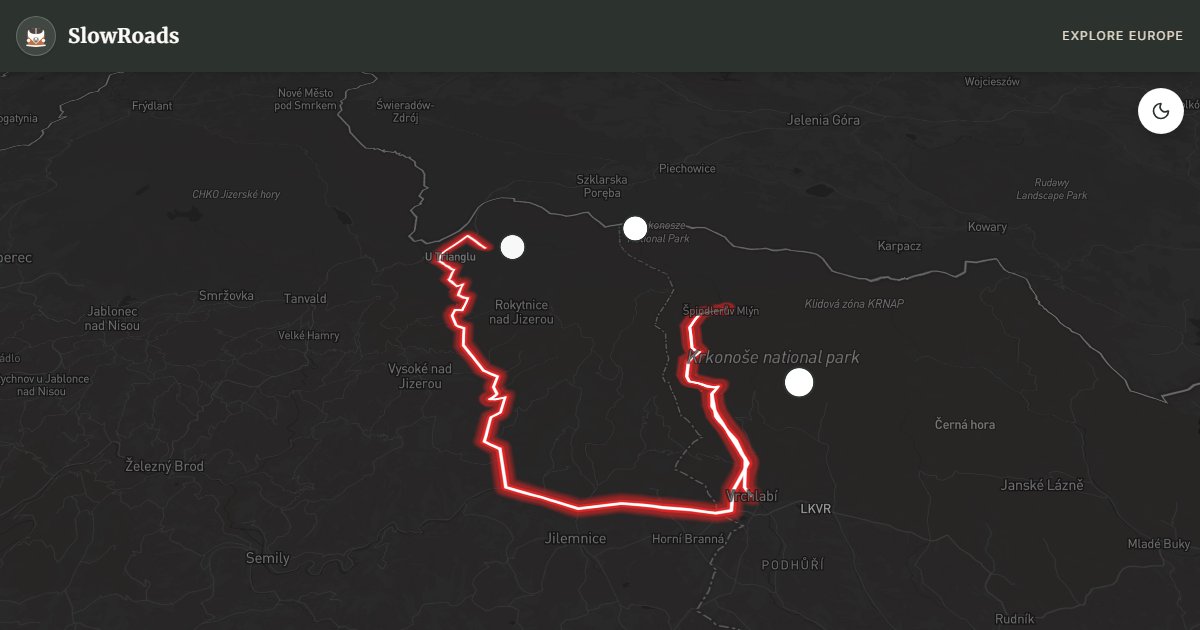
Cross the Krkonoše valleys from Vrchlabí to Harrachov — about 61 km toward Sněžka (1,603 m), Czechia's highest peak. Sustained climbs and shaded hairpins demand respect from classic and low-power campervans: cool early, use low gears, and engine-brake on descents. Mumlava waterfall and Elbe-source ridge walks reward stops; overnight at Autokemp only — national-park wild camping is banned. Winter tyres matter November–March when ice lingers in shade. May–June and September are kinder than peak ski-town weekends. Check brakes and coolant before you leave the valley floor.
Detailed Route Guide
The Krkonoše, or Giant Mountains, form the highest mountain range in the Czech Republic and one of the oldest protected mountain areas in Central Europe, with a national park established in 1963. This 61-kilometre route from Vrchlabí to Harrachov crosses the heart of the range through a landscape of spruce forests, alpine meadows, cascading streams, and striking granite formations. At its centre stands Sněžka, at 1,603 metres the highest peak in Bohemia, whose distinctive rounded summit is visible from much of the route. The mountains have been a destination for Central European hikers and skiers for over 150 years, and the infrastructure reflects that heritage.
The route's engineering highlights include the main ridge road that approaches the Polish border and the valley descents toward Harrachov on the western side. The Mumlava waterfall, dropping in stages over massive granite boulders and creating deep water-carved pots (obří hrnce) in the rock, is one of the finest natural spectacles in the Czech mountains. Near the Elbe spring, a modest stone well marks the point where one of Europe's great rivers begins its 1,091-kilometre journey to the North Sea. The ski resort town of Špindlerův Mlýn, while dominated by large hotels in summer, gives access to the high-altitude trails above the tree line.
For a classic / low-power campervan driver, this route requires honest preparation and realistic expectations. The climbs are sustained and significant, particularly the approaches to the ridge from both sides. First and second gear will be used frequently. Brake fade can occur on the long descents if brakes are already worn. Coolant temperature should be monitored on the climbs. That said, the roads are excellent quality and the route is entirely feasible for a well-maintained classic campervan. The reward is mountain air, dramatic scenery, and the satisfaction of a genuine alpine crossing at moderate altitude.
The best time to drive this route is June through September, when the mountain roads are clear and the weather is stable enough for the long valley views. July and August are the busiest months, with the ski resorts attracting summer walkers and cyclists. Early June often still has snow on the highest sections. October is beautiful but weather can turn quickly. The route is not recommended for older campervans in winter without extensive cold-weather preparation, as snowfall can close the ridge road entirely.
Before you climb, verify coolant, thermostat, brake pads and fluid — the risk on this route is mechanical heat and fade, not cliff-edge driving. Use low gears on descents into Harrachov; do not ride the brakes. Start early from Vrchlabí to avoid summer resort traffic in Špindlerův Mlýn. Ridge sections can close with snow from November into spring; check dopravniinfo.cz and fit winter tyres when conditions require them (from 1 November in snowy conditions).
Sněžka itself is walk or cable car only — leave the van in Pec pod Sněžkou or enjoy roadside viewpoints toward the pyramid summit. Overnight at Camping Labská or quieter Harrachov sites; national-park wild camping is illegal. June–September is the realistic window for older campervans; October is beautiful but weather turns fast. Carry spare coolant water and allow the engine to idle and cool on pull-offs if the gauge climbs.
Frequently Asked Questions
Points of Interest
Source of the Elbe (nearby)
Nature
A symbolic stone well on the ridge where the great European river Elbe begins its journey.
Mumlava Waterfall
Nature
A powerful waterfall dropping over massive granite blocks, featuring deep 'giant pots' carved by the water.
Sněžka Viewpoint
Nature
A dramatic overlook towards the pyramid-shaped peak of Sněžka, the highest point in Czechia.
Route Highlights
Route Information
Navigation
* Supported by HERE Technologies, headquartered in Amsterdam, Europe. Precise routing through all waypoints.
* Waze only navigates to the starting point. Use Google Maps for the full scenic route.
Offline GPS Navigation
Download the GPX route file to navigate offline using your favorite GPS device or app (Garmin, TomTom, OsmAnd, Gaia GPS).
Ask Copilot (AI Travel Guide)
Hello! I am your SlowRoads Copilot. I know the Giant Mountains (Krkonoše) Panorama intimately. Ask me about scenic viewpoints, local history, hidden culinary gems, or the best camper spots along the way!