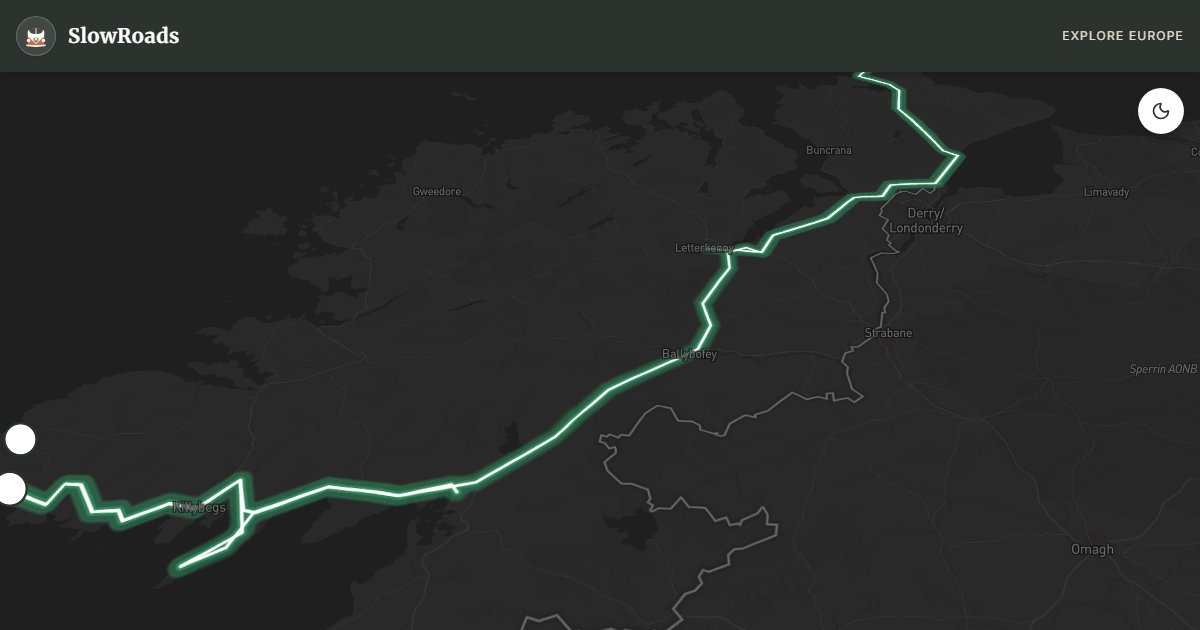
About This Route
Drive Donegal’s Wild Atlantic from Letterkenny toward Malin Head and Slieve League — about 297 km of Gaeltacht villages, windy cliffs, and steep coastal lanes for careful classic campervans. Left-hand traffic; expect strong Atlantic gusts and narrow pull-ins more than long climbs. Slieve League viewpoints and Malin Head reward early, clear days. Official campsites only — no wild-camping right. Two to three slow days suit older low-power vans. Fill fuel in Letterkenny or coastal towns before quieter headlands. May–June and September beat midges and peak coach traffic; winter storms can close exposed cliff roads.
Detailed Route Guide
One hundred and eighty kilometres of Donegal's Wild Atlantic Way run from Letterkenny through Ireland's Gaelic-speaking northwest to Donegal Town — peat bog under Atlantic cloud, Gaeltacht villages, and Slieve League's sea cliffs rising far higher than the Cliffs of Moher without the same coach-park queues. This is steep, exposed driving: switchbacks above big drops toward Slieve League, sideways gusts on the R242 to Malin Head, and gradients on the Glengesh Pass between Ardara and Glencolmcille. A classic or low-power campervan handles Donegal if you respect the terrain — low gears on climbs, engine braking on descents, coolant watched on treeless moor. Allow two to three days; rushing this coast defeats the point.
Malin Head at the northern extremity is a windswept promontory of radio masts, wartime lookouts and seabirds, with views across Inishowen toward Tory Island on clear days. Slieve League deserves a full morning: park at the upper Bunglas viewpoint and walk the cliff path toward One Man's Pass only if conditions allow — the road to the lower viewpoint is narrow enough that meeting traffic means reversing, and a loaded camper should stay at the upper lot. Glenveagh National Park, a detour east of Letterkenny, wraps Victorian castle and oak woodland around Lough Veagh. Glencolmcille's folk village and the Gaeltacht harbours of Kilcar and Killybegs keep Irish-language culture beside working fishing boats.
Campervan logistics need forethought. Letterkenny offers fuel and supplies before you head north; Bundoran campsite suits the southern Donegal Bay end; Glencolmcille folk-village parking may tolerate quiet overnights with permission. Slieve League's upper car park closes at dusk — do not overnight at cliff-edge lay-bys where spray and gusts make sleeping unsafe. Wild camping is not a legal right — ask landowners, stay discreet if overnighting, and never block farm gates on narrow boreens. Fill up before the Inishowen loop; shops close early on remote stretches.
May brings long northern evenings at Malin Head and early heather on Slieve League slopes before peak summer buses. September strips the cliffs of crowds while staying mild enough for coastal walks and Donegal Town harbour pubs. Winter storms can close the Slieve League viewpoint for days and ice Glengesh — check Met Éireann and county road updates before exposed sections. Two days cover Letterkenny, Malin Head and Slieve League; add a third for Glenveagh, Glencolmcille and a slow finish in Donegal Town.
Donegal rewards travellers who treat wind as a planning factor, not an afterthought. High-sided classic campervans catch gusts on cliff approaches — if Met Éireann warns of severe Atlantic gales, postpone Slieve League and explore Glenveagh's sheltered woodland instead. Carry layers even in May; the temperature drop between Letterkenny and Malin Head can surprise. Fuel, cash and a full water tank matter more here than on Kerry's busier loop because services thin out between harbour towns. When you meet a tractor or school bus on a boreen, reverse to the nearest wide spot without drama — local drivers expect that courtesy. Two slow days with long stops beat three rushed ones; the point of this northern Wild Atlantic stretch is the space between the famous viewpoints.
Frequently Asked Questions
Points of Interest
Malin Head
Nature
Ireland's northernmost point
Slieve League
Nature
Sea cliffs rising about 600 m
Glencolmcille
Town
Gaeltacht heritage village
Route Highlights
Route Information
Navigation
* Supported by HERE Technologies, headquartered in Amsterdam, Europe. Precise routing through all waypoints.
* Waze only navigates to the starting point. Use Google Maps for the full scenic route.
Offline GPS Navigation
Download the GPX route file to navigate offline using your favorite GPS device or app (Garmin, TomTom, OsmAnd, Gaia GPS).