Causeway Coastal Route (Full)
About This Route
The complete Antrim coast experience — from Belfast through all nine Glens, Torr Head, Carrick-a-Rede, Giant's Causeway, and on to Derry~Londonderry with every scenic detour included.
Detailed Route Guide
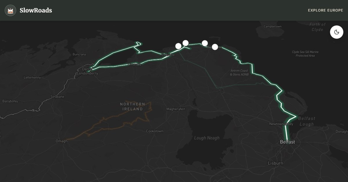
The full Causeway Coastal Route is Northern Ireland's definitive slow-travel road — a 280-kilometre journey from Belfast to Derry~Londonderry that takes in every dramatic inch of the Antrim coast rather than rushing the highlights. While the shorter Belfast-to-Causeway section is well known, the complete route rewards those who allow three or four days to explore the nine Glens of Antrim, cross Torr Head (the closest point on the island of Ireland to Scotland, where on clear days the Mull of Kintyre appears close enough to touch), walk the Carrick-a-Rede rope bridge, and linger at Dunluce Castle before the road turns west toward the walled city of Derry. For a VW T3 crew, this is van-friendly territory: the A2 is well surfaced, gradients are modest, and wild camping culture is less established than in Scotland but overnight parking at harbours and campgrounds is straightforward.
Leaving Belfast via the M2 and A2, the route skirts Belfast Lough before Carrickfergus Castle — one of Ireland's best-preserved Norman fortresses — marks the transition to open coast. Larne begins the Antrim coast proper, and from here the road weaves through Glenarm, Carnlough, and Cushendall, each glen cutting back into heather-covered hills with waterfalls and stone walls. Cushendun, a National Trust village of whitewashed cottages, is one of the most photogenic stops on the entire route. The climb to Torr Head on the R151 detour is narrow and demands patience in a T3, but the view across the North Channel to Scotland is unforgettable.
The central section from Ballycastle to Bushmills concentrates the route's geological drama. Carrick-a-Rede rope bridge — suspended 30 metres above the churning Atlantic — requires timed tickets in summer but is manageable year-round with advance booking. The Giant's Causeway UNESCO site needs no introduction: 40,000 interlocking basalt columns stepping into the sea, best approached via the cliff-top path from Bushmills rather than the busy visitor centre car park. Dunluce Castle, perched on a sea stack, adds medieval romance. Old Bushmills Distillery (1608) sits between these wonders.
West of the Causeway, the coast softens toward Portstewart and Downhill before the route enters County Derry. Mussenden Temple on the clifftop at Downhill is a neoclassical folly with extraordinary views. The final approach to Derry~Londonderry crosses the Foyle estuary to a walled city whose 17th-century fortifications remain complete — a fitting end to one of Europe's great coastal drives. Allow three days minimum; four if you walk glens, visit Rathlin Island ferry from Ballycastle, or explore the Dark Hedges near Ballymoney as a morning detour.
Frequently Asked Questions
Points of Interest
Carrick-a-Rede Rope Bridge
Nature
Dramatic rope bridge to island
Giant's Causeway
Nature
UNESCO basalt columns
Torr Head
Nature
Closest point to Scotland
Dunluce Castle
Castle
Cliff-perched medieval fortress
Route Highlights
Route Information
* Waze only navigates to the starting point. Use Google Maps for the full scenic route.
Ask Copilot (AI Travel Guide)
Hello! I am your SlowRoads Copilot. I know the Causeway Coastal Route (Full) intimately. Ask me about scenic viewpoints, local history, hidden culinary gems, or the best camper spots along the way!