About This Route
Estonia's largest island — Kuressaare bishop's castle, Kaali meteorite crater, Angla windmills, and juniper coast on quiet island roads. Ferry from Virtsu is required (praamid.ee); book vehicle space in peak summer for classic and low-power campervans. Mostly flat with occasional single-lane sections where you give way at lay-bys and keep speeds modest. Fuel and supplies in Kuressaare before looping the west coast. A two-to-three-day island pace rewards wind, limestone light, and empty evening harbours. WARNING: Single-lane sections; ferry queues in July–August.
Detailed Route Guide
Saaremaa is Estonia's island apart — the country's largest island, reachable only by ferry from Virtsu on the mainland, where time moves slower, roads narrow to single lanes with lay-bys for passing, and a distinct island culture preserves windmills, juniper-smoked ale, and a bishop's castle that anchored medieval power in the Baltic. This roughly 166-kilometre loop from Kuivastu ferry terminal through Kuressaare, Kaali crater, Angla windmills, and the island's north and south capes is Estonia's essential island slow road — mechanically gentle but logistically requiring ferry planning and patience on narrow lanes.
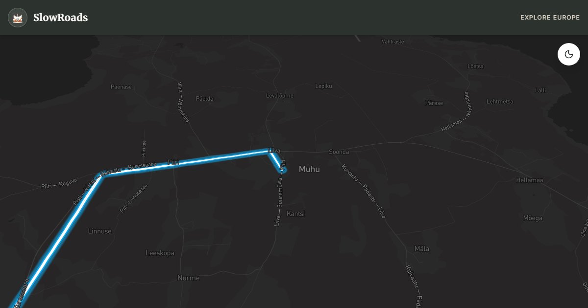
The ferry from Virtsu to Kuivastu runs hourly in season — thirty minutes crossing, book ahead with vehicle in peak summer. Kuivastu lands you on an island of limestone bedrock, juniper scrub, and fields bounded by dry-stone walls. Kuressaare, the island capital, centres on a fourteenth-century moated castle — Estonia's best-preserved medieval fortress with museum, moat walk, and a spa town grown around therapeutic mud baths since the nineteenth century. Allow a full day for Kuressaare: castle, old town, and waterfront promenade.
Kaali meteorite crater field is Saaremaa's geological wonder — a meteorite struck here 3,500 years ago creating nine craters, the largest 110 metres across and 22 metres deep, referenced in Estonian folk songs as the sun falling from the sky. Angla windmill hill preserves five wooden windmills — the iconic Saaremaa postcard view. Panga cliff on the north coast rises 21 metres above the Baltic — an ancient sacrificial site with juniper-covered limestone. Sõrve lighthouse at the southern tip marks windswept coast where Soviet military installations once dominated.
For classic and low-power campervan travellers, Saaremaa demands three to four days minimum. Roads are flat but narrow — use lay-bys for oncoming traffic. Fuel on island; stock supplies in Kuressaare. Camp at official sites or Kuressaare periphery. May through September; ferry reduces in winter. Pair with Muhu island (connected by causeway) or mainland Pärnu coast.
Book Virtsu–Kuivastu at praamid.ee and declare vehicle length; arrive 30 minutes early. Single-lane island roads use marked lay-bys (põikvahed) — the nearer vehicle yields. Fuel in Kuressaare and Kuivastu on arrival. Three days minimum for the loop; four if you add Sõrve cape and Muhu via the causeway. Classic campervans face no grades, only patience and ferry timing. Camp at official sites or Kuressaare periphery — island wild camping is not a safe assumption.
Book Virtsu–Kuivastu on praamid.ee and arrive thirty minutes early in July–August; van lanes fill. On the island, Kuressaare is the service hub — fuel, shops, and campsites — before you fan out to Kaali crater, Angla windmills, and Sõrve tip. Single-track coastal sections need patience; reverse to passing places rather than mounting soft verges. Classic and low-power campervans love the flat island roads; the ferry timetable and wind on Sõrve are the real planning constraints. Allow three to four days so you are not rushing the last ferry. Sõrve lighthouse tip is exposed — turn back if crosswinds unsettle a high-sided van. Evening ferry slots sell out in peak weeks; keep a buffer night on the island rather than gambling the last sailing.
Frequently Asked Questions
Points of Interest
Kuressaare Castle
Castle
A fourteenth-century bishop's castle on a moated island — Estonia's best-preserved medieval fortress with spa town.
Kaali Meteorite Crater
Nature
A roughly 3,500-year-old meteorite impact crater — nine craters in a field, sacred site in Estonian folklore.
Angla Windmill Hill
Monument
Five restored wooden windmills on a hill — iconic Saaremaa landscape and museum.
Sõrve Lighthouse
Monument
A lighthouse at Saaremaa's southern tip — windswept juniper coast and military history.
Panga Cliff
Nature
A 21-metre limestone cliff on the north coast — ancient sacrificial site with Baltic Sea views.
Route Highlights
Route Information
Navigation
* Supported by HERE Technologies, headquartered in Amsterdam, Europe. Precise routing through all waypoints.
* Waze only navigates to the starting point. Use Google Maps for the full scenic route.
Offline GPS Navigation
Download the GPX route file to navigate offline using your favorite GPS device or app (Garmin, TomTom, OsmAnd, Gaia GPS).
Ask Copilot (AI Travel Guide)
Hello! I am your SlowRoads Copilot. I know the Saaremaa Island Loop intimately. Ask me about scenic viewpoints, local history, hidden culinary gems, or the best camper spots along the way!