About This Route
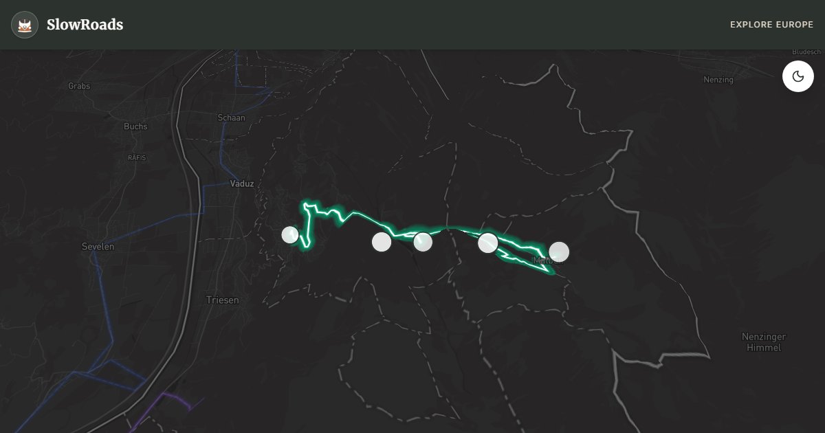
Liechtenstein's only ski-resort road — Triesenberg to Malbun through larch forests and alpine meadows with Samina valley views. Switchbacks reach around 10–12%; classic and low-power campervans need early starts, low gears, and cooling pauses. Winter chains are required above about 1,400 m when signed. Short distance, real altitude — treat it as a mountain half-day, then descend to Rhine-level services. Summit meadows reward the climb with quiet picnic pullouts. WARNING: Steep access; chains in winter above ~1,400 m. Allow extra time for photo pullouts, fuel stops, and cooling breaks in older vans.
Detailed Route Guide
Malbun is Liechtenstein's roof — the principality's only alpine resort, reached by a 13-kilometre climb from Triesenberg through larch forests and cow pastures to a plateau at 1,600 metres where Samina valley views drop to the Rhine and Swiss peaks line the horizon. For slow van travellers, the Malbun road is the country's only genuine mountain driving challenge: sustained switchbacks with grades reaching around 10–12%, narrow lanes with occasional oncoming ski buses, and winter conditions that demand chains from November through April.
Triesenberg anchors the climb — a Walser village perched above the Rhine valley with a heritage museum documenting the Swiss settlers who colonised these slopes in the thirteenth century. The village church and scattered Walser houses make a contemplative start; van parking at the church lot or Malbun road junction. From Triesenberg, the mountain road ascends through forest switchbacks where classic campervan drivers should climb in second gear and use a roadside viewpoint as a cooling stop — the Rhine valley spreads 800 metres below through a gap in the larch trees.
Malbun village at the summit is compact — a handful of hotels, mountain restaurants, and ski infrastructure that transforms in summer into hiking hub for ridge trails to Sareis and the Gafadura hut. The Sareis chairlift (summer operation) lifts walkers to panoramic ridges where Liechtenstein, Switzerland, and Austria are visible simultaneously. Allow a full day: morning climb, ridge walk or chairlift, afternoon descent in low gear.
For classic and low-power campervan drivers, Malbun is manageable but demands respect — the steepest sections are on the lower third of the climb where the road is narrowest. Avoid mid-afternoon summer heat on the ascent. Parking at Malbun village lot fits vans but fills on ski weekends. June through September for hiking; December through March for skiing with mandatory winter equipment. Pair with the Rhine valley route below or Switzerland's Appenzell hills for a complete Liechtenstein vertical slice.
Climb early to avoid summer heat and ski-bus traffic; cool at the Samina viewpoint mid-climb. Chains are mandatory above 1,400 m when signed (typically November–April). No formal campsite at Malbun — ask hotels or overnight in Triesenberg valley guesthouses. Sareis chairlift (June–October, weather dependent) saves a steep ridge hike. Classic and low-power campervans manage ~10–12% in second gear with respect; do not force the climb with a hot engine. Pair with the Rhine L2 below for a full vertical day.
The Malbun climb averages roughly 10–12% on sustained sections — cool the engine at pull-offs, use low gears, and avoid midday heat in a loaded classic campervan. The village has parking and services in season; winter brings ski traffic and possible chain rules. Do not treat Malbun as a casual detour after a long Swiss day — arrive with margin for cooling stops. Long vehicles struggle on hairpins; if your camper is very long, walk the last scenic stretches from lower lots when space is tight. Descend in the same low gears you climbed — brake fade on repeated stops is the risk in a loaded classic campervan. If temperatures soar, wait for late afternoon before the final push to the village. Photographers often walk the last hairpins from a mid-climb lot when parking above is full.
Frequently Asked Questions
Points of Interest
Triesenberg Walser Museum
Monument
Walser heritage centre documenting the Swiss settlers who colonised Liechtenstein's alpine slopes.
Sareis Chairlift Base
Nature
Summer chairlift to ridge viewpoints over the Rhine valley and Swiss Alps — Malbun's panorama hub.
Malbun Village
Town
A compact alpine resort at 1,600 m — hotels, mountain restaurants, and summer hiking trailheads.
Gafadura Alpine Hut
Nature
A traditional mountain hut on the ridge trail — cheese, soup, and views to three countries.
Samina Valley Viewpoint
Nature
A roadside pullout on the Malbun climb — Rhine valley views open through gaps in the forest.
Route Highlights
Route Information
Navigation
* Supported by HERE Technologies, headquartered in Amsterdam, Europe. Precise routing through all waypoints.
* Waze only navigates to the starting point. Use Google Maps for the full scenic route.
Offline GPS Navigation
Download the GPX route file to navigate offline using your favorite GPS device or app (Garmin, TomTom, OsmAnd, Gaia GPS).
Ask Copilot (AI Travel Guide)
Hello! I am your SlowRoads Copilot. I know the Malbun Alpine Plateau intimately. Ask me about scenic viewpoints, local history, hidden culinary gems, or the best camper spots along the way!