About This Route
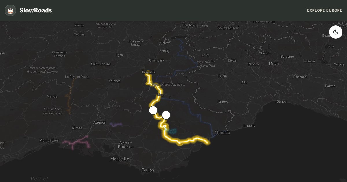
Follow Napoleon's 1815 return from Elba on the Route Napoléon (N85) from Golfe-Juan to Grenoble: Provençal foothills, lavender near Digne, and the Sisteron citadel above the Durance. Less extreme than the high Alpine cols, but the sustained climb from the coast through Grasse still needs cooling stops in an older campervan. Ideal as a 4–5 day slow drive with a Verdon detour from Castellane. Eagle markers and plaques punctuate the national road; May and September are quieter than July heat in the Var gorges. Campgrounds at Castellane, Sisteron and Gap keep overnighting legal and easy.
Detailed Route Guide
The Route Napoléon (N85) follows the path taken by Napoleon Bonaparte in March 1815 when he returned from exile on the island of Elba with 1,000 men, landing at Golfe-Juan near Antibes and marching north through the Provençal Alps to Grenoble — a 320-kilometre journey that France was supposed to oppose and instead largely celebrated. The route's historical drama and its physical beauty through the Provence foothills and Hautes-Alpes make it one of the most satisfying drives in southern France for slow travellers who want story and scenery without the extreme altitudes of the Grandes Alpes.
The journey begins at Golfe-Juan, today a yacht harbour and beach suburb of Antibes on the Côte d'Azur, where a simple plaque marks Napoleon's landing point. From here the road climbs rapidly away from the coast into the Alpes-Maritimes, passing through Grasse — the perfume capital of the world, where the micro-climate of limestone hillsides growing jasmine, rose, and mimosa supports an industry of extraordinary refinement. The Musée International de la Parfumerie and the perfume houses (Fragonard, Galimard) offer tours even for passing travellers.
Beyond Grasse the road enters the spectacular Var Gorges and then the Préalpes de Digne — a landscape of eroded limestone cliffs, lavender fields (in bloom late June to mid-August), and the characteristic pale-blue and ochre villages of Haute-Provence. Castellane, perched below the vertical cliff of the Roc (an 180-metre limestone butte) is the natural pause point and the gateway to the Verdon Gorges. The town Napoleon passed through on March 3rd, 1815 is today a hiking and climbing centre with a lively market.
Sisteron is the route's most dramatic fortress stop: a great citadel that completely controls the narrow gap where the Durance River cuts through the Préalpes. Napoleon passed through its gates on March 5th, 1815 — there is a plaque in the citadel where the garrison commander who was supposed to block his passage decided instead to let him through. The view from the ramparts up and down the Durance Valley is extraordinary. Gap, further north, is a pleasant Napoleonic-era provincial capital with good facilities and a base for the approach to Grenoble. Eagle markers (Napoleon's emblem) and commemorative plaques punctuate the N85 throughout, tying the asphalt to the Hundred Days that ended at Waterloo.
For classic and low-power campervan drivers: the Route Napoléon is steep in places but generally less extreme than the true high passes of the Grandes Alpes. The climb from the coast through Grasse to Castellane is significant and sustained — plan for cooling stops and second gear, and use engine braking on the descents. The road between Castellane and Digne is spectacular but well-maintained national road (two lanes). From Digne northward the road is progressively less steep. Campgrounds are available at Castellane (popular summer base for Verdon), Sisteron, Gap and Corps. Overnight on official aires and campsites rather than informal gorge pull-offs. Late June to mid-August brings lavender on the Plateau de Valensole (a short detour near Digne); May and September offer quieter roads. Total: a challenging but achievable southern French drive that rewards preparation with stunning Provençal scenery.
Frequently Asked Questions
Points of Interest
Imperial Eagle Marker (Digne)
Monument
Sisteron Citadel
Castle
Route Highlights
Route Information
Navigation
* Supported by HERE Technologies, headquartered in Amsterdam, Europe. Precise routing through all waypoints.
* Waze only navigates to the starting point. Use Google Maps for the full scenic route.
Offline GPS Navigation
Download the GPX route file to navigate offline using your favorite GPS device or app (Garmin, TomTom, OsmAnd, Gaia GPS).