About This Route
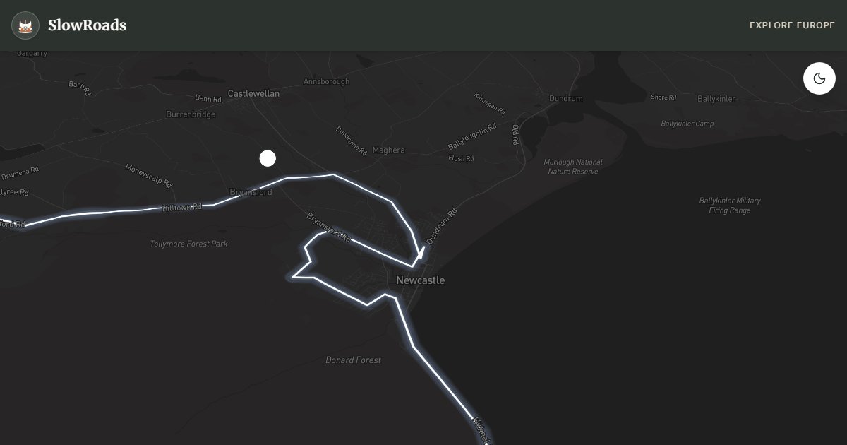
About 82 km of granite loop from Newcastle — Silent Valley reservoir, Spelga Pass moorland grades, Tollymore Forest, and Slieve Donard (850 m) as the skyline. Steeper than the Causeway for classic and low-power campervans; use low gears on Spelga and cool at pullouts. Campsites in Newcastle; no wild camping on the moors. Mist and rain arrive fast — layers and short stages. A compact mountain day inland from the coast, rewarding with empty high ground when Atlantic cliffs feel crowded.
Detailed Route Guide
The Mourne Mountains Loop is Northern Ireland's mountain masterpiece — a 82-kilometre circuit from the seaside town of Newcastle through the granite heart of the Mournes, where CS Lewis found the landscape that would become Narnia and where the mountains "sweep down to the sea" in the famous song. Slieve Donard at 850 metres is the highest peak in Northern Ireland, and the road loop through Silent Valley and over Spelga Pass delivers mountain grandeur accessible in a classic campervan without requiring a full highland expedition. This is steep country in places: Spelga Pass crosses open moorland above Spelga Dam with exposed gradients that demand lower gears and careful engine braking on descent.
Newcastle makes the ideal base — a Victorian resort town with a promenade, fish and chip shops, and direct access to the mountain footpaths. The loop begins by heading west into the mountains via the Head Road and Annalong Valley approaches. Silent Valley Reservoir sits in a granite amphitheatre of extraordinary beauty: the dam and visitor centre explain how Belfast's water supply was secured in this remote valley, and walking trails circle the reservoir beneath the cirque of peaks.
Spelga Pass is the route's high point — a narrow road across open moorland with views across the Spelga Dam and the distant Irish Sea on clear days. For a classic campervan, this is the section requiring most attention: engage second gear on the climb, watch for sheep on the road, and never attempt the pass in ice or fog. The descent toward Hilltown and the return leg via Bryansford and Tollymore Forest Park — a Victorian arboretum with exotic trees and the Shimna River — completes the circuit.
The Mournes are busiest on summer weekends when Dublin and Belfast day-trippers arrive for Donard summit hikes. Midweek visits in May, June, or September offer solitude and extraordinary light on the granite tors. Wild camping is restricted in much of the area — use the Silent Valley car park (day visit only) or Newcastle's caravan parks for overnight stays. The Mourne Wall — a roughly 31km dry-stone wall crossing 15 summits — is visible from multiple points on the loop and defines the landscape as few human structures can.
Spelga Pass is the mechanical crux — second gear climb, engine braking descent, skip ice and fog. Silent Valley is day-visit parking only; overnight in Newcastle caravan parks. Midweek May–June or September beats summer weekend crowds from Belfast and Dublin. The Mourne Wall (~31 km across 15 summits) is visible from multiple pullouts. Classic campervans manage the loop with respect for sheep and exposure. Pair with the Causeway coast for mountain-and-sea contrast.
Spelga Pass is the mechanical crux — low gears up, engine braking down, and never in ice or thick fog in a classic campervan. Newcastle campsites are the practical base; do not overnight on exposed moor pull-offs. Silent Valley and Tollymore are walk-heavy stops with signed parking. Sheep on the road are constant — expect sudden stops. Pair with the Causeway coast only if you leave a recovery day between mountain grades and coastal mileage.
Frequently Asked Questions
Points of Interest
Silent Valley Reservoir
Nature
Belfast water-supply reservoir in a granite cirque — visitor centre and lakeside walks; day parking only.
Spelga Pass
Nature
Exposed moorland pass above Spelga Dam — use low gears in classic campervans; sheep on the road.
Slieve Donard
Nature
Highest peak in Northern Ireland (850m)
Tollymore Forest Park
Nature
Victorian arboretum and river walks
Route Highlights
Route Information
Navigation
* Supported by HERE Technologies, headquartered in Amsterdam, Europe. Precise routing through all waypoints.
* Waze only navigates to the starting point. Use Google Maps for the full scenic route.
Offline GPS Navigation
Download the GPX route file to navigate offline using your favorite GPS device or app (Garmin, TomTom, OsmAnd, Gaia GPS).