About This Route
A languid drive along the Balkans' largest lake — half Montenegro, half Albania — through wine country, floating meadows, and the horseshoe bend at Rijeka Crnojevića. Mostly flat roads ideal for slow vans. WARNING: The M2.4 lakeside road is narrow with soft shoulders; boat trips from Virpazar are the best way to see pelicans and monasteries.
Detailed Route Guide
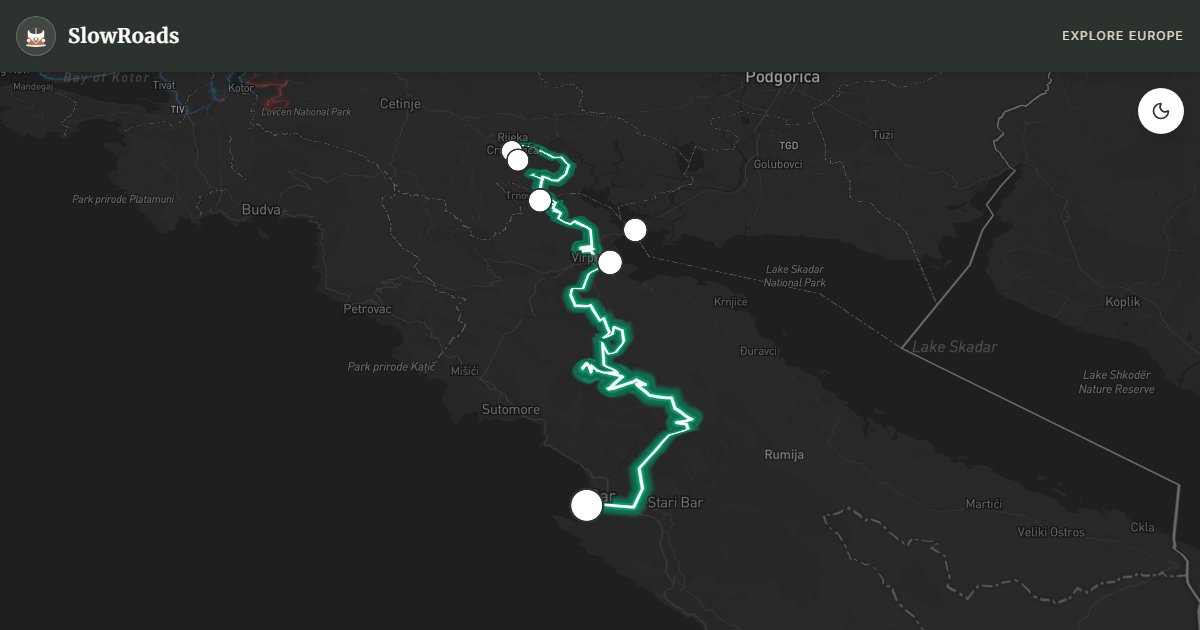
Lake Skadar — known locally as Skadarsko Jezero — is the largest lake in the Balkan Peninsula and one of the most ecologically significant wetlands in Europe. Shared between Montenegro (roughly two-thirds) and Albania, it supports over 280 bird species including the rare Dalmatian pelican, and its shoreline of floating water-lily meadows, submerged karst springs, and vine-covered hills feels more like the Danube Delta than the Adriatic coast just thirty kilometres away. The scenic drive from Virpazar to Bar, approximately ninety kilometres along the lake's western and southern shores, is Montenegro's most underrated slow-travel route — flat, quiet, and rich in wine, wildlife, and unexpected beauty.
Virpazar is the gateway. This small lakeside village of stone houses and waterfront restaurants serves as the main access point for Lake Skadar National Park. From here, boat trips depart daily (€15–30 per person, two to three hours) to see pelican colonies, island monasteries like Beška and Starčevo, and the floating meadows of lirići — water plants that carpet the shallows in green. Even if you skip the boat, Virpazar's wine cellars offer tastings of Vranac, Montenegro's indigenous red grape, for a few euros a glass. The national park visitor centre provides maps and birding guides.
The road northwest from Virpazar toward Rijeka Crnojevića follows the Crnojević River as it bends through the famous horseshoe curve at Pavlova Strana — one of the most photographed landscapes in Montenegro, where the river doubles back on itself beneath vine-covered hills. Rijeka Crnojevića itself is a tiny settlement with a restored stone bridge and kayak rental; the viewpoint above the bend is a five-minute walk from a roadside pullout. Continuing south, the road passes Vranjina — a hill-island connected to the mainland by a causeway, with monastery ruins and excellent birdwatching from the shore.
The southern shore toward Bar is quieter and less developed. Small fishing villages, roadside honey sellers, and olive groves line the route. Bar itself combines a modern port town with Stari Bar — a ruined medieval city on the hillside above, abandoned after an earthquake in 1979 and now a haunting open-air museum of stone walls, cypress trees, and a still-functioning aqueduct. The old town's olive tree, claimed to be over 2,000 years old, is worth the climb.
For VW T3 drivers, this route is a relief after Kotor's serpentines — essentially flat, well-paved, and uncrowded outside August. The M2.4 lakeside sections are narrow with soft gravel shoulders; take care when meeting oncoming traffic. Allow two days: one for the drive with stops, one for a boat trip from Virpazar. May and June bring wildflowers and nesting birds; September offers grape harvest in the surrounding vineyards.
Frequently Asked Questions
Points of Interest
Virpazar Village
Town
Lake-side hub for boat tours, wine tasting, and the park visitor centre.
Rijeka Crnojevića
Town
Historic river town at the lake's horseshoe bend — stone bridge and kayak launches.
Pavlova Strana Viewpoint
Nature
The iconic aerial-view bend where the Crnojević River meets the lake.
Vranjina Island
Nature
A hill-island in the lake connected by causeway — monastery ruins and birdwatching.
Godinje Wine Village
Wine Region
Abandoned-then-revived hill village producing Vranac red wine with lake views.
Old Bar Fortress
Monument
Ruined medieval town on a hillside above modern Bar — aqueduct and olive groves.
Route Highlights
Route Information
* Waze only navigates to the starting point. Use Google Maps for the full scenic route.
Ask Copilot (AI Travel Guide)
Hello! I am your SlowRoads Copilot. I know the Lake Skadar Scenic Drive intimately. Ask me about scenic viewpoints, local history, hidden culinary gems, or the best camper spots along the way!