About This Route
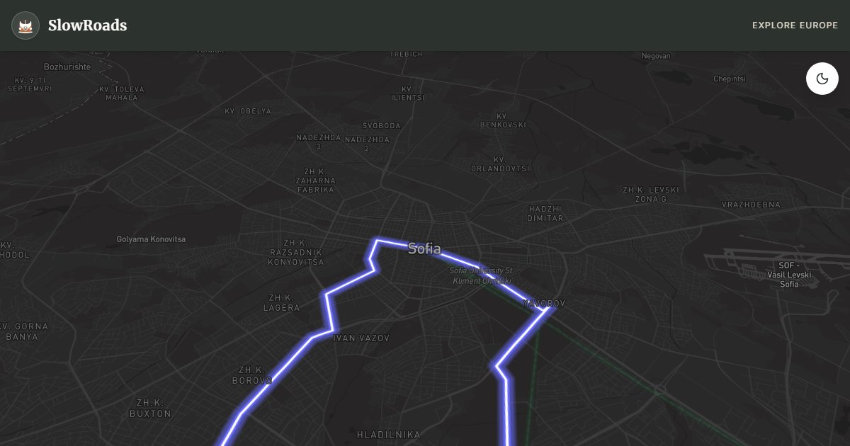
Sofia's backyard wilderness — from Boyana Church UNESCO frescoes through Dragalevtsi village to Vitosha's stone rivers, Aleko meadow, and Golden Bridges karst plateau. A half-day to full-day loop escaping the capital on roads reaching 7–9% near the summit; classic and low-power campervans should climb early and cool at pullouts. Weekend traffic from Sofia is heavy; winter often closes above about 1,400 m. Park at marked lots and hike stone rivers on foot. Urban-to-alpine contrast within an hour of the city — perfect before or after longer Bulgarian stages.
Detailed Route Guide
Vitosha Mountain rises directly from Sofia's southern suburbs — a 2,290-metre granite massif where stone rivers of rounded boulders flow across alpine meadows, ski lifts serve weekend Sofia families, and UNESCO frescoes hide in a church just fifteen minutes from the capital's ring road. For van travellers staging in Sofia before longer Bulgarian loops, the Vitosha escape is the perfect half-day shakedown: roughly 68 kilometres of forest road loop testing your van on genuine mountain grades without committing to multi-day mountain logistics.
Begin at Boyana Church on Sofia's southwestern edge — a UNESCO site whose interior thirteenth-century frescoes represent the pinnacle of Bulgarian medieval painting. Parking accommodates vans in the lower lot; visit early before coach groups from the capital arrive. From Boyana, the road climbs through pine forest toward Dragalevtsi village — a foothill settlement with restaurants, a monastery, and the main signed route toward Vitosha's interior.
The ascent from Dragalevtsi to Aleko meadow follows a well-maintained forest road that gains 700 metres of elevation on switchbacks reaching 7–9% gradient — the steepest sustained climbing in Sofia's immediate hinterland. Classic and low-power campervan drivers should climb in second gear, monitor temperature gauges on hot summer afternoons, and use Aleko's meadow parking as a cooling stop before continuing. At 1,810 metres, Aleko offers ski-centre infrastructure (closed in summer but parking and toilets remain), meadow panoramas toward the Balkan plain, and a junction toward Golden Bridges.
Golden Bridges — Zlatnite Mostove — is Vitosha's signature natural wonder: a plateau where granite boulders the size of cars appear to flow like a frozen river across alpine grassland at 1,450 metres. The forest road approach is narrower than the Aleko ascent but with gentler grades; parking at the trailhead fills on sunny weekends when Sofia families escape the city heat. Walk among the boulders for thirty minutes — the scale is genuinely surprising so close to a capital city.
The loop descends via Kopitoto viewpoint at 1,340 metres — a TV tower terrace with the entire Sofia basin spread below, snow-capped Rila visible on clear days to the south. Return to the capital on suburban roads through Boyana or Dragalevtsi, completing the circuit in four to six hours including stops.
Sofia itself rewards a day or two before or after the Vitosha loop — the Alexander Nevsky Cathedral, Roman Serdica ruins beneath the metro centre, and the Saturday flea market where communist-era memorabilia and rose attar share stall space. Van parking exists at stadium lots south of the centre and at several municipal autocamps on the ring road; use these rather than attempting the historic core with a long-wheelbase van.
For classic and low-power campervan drivers, Vitosha is a diagnostic drive: if your van climbs Dragalevtsi–Aleko comfortably, Shipka and Rila await with confidence. If overheating occurs, address cooling before longer mountain routes — Sofia has air-cooled specialist garages familiar with classic air-cooled and older diesel engines. The mountain also teaches Bulgarian driving culture: locals overtake on blind corners with confidence you may not share; pull left and let faster traffic pass on the forest road without ego. LPG and full services are in Sofia — fuel before ascending because no stations exist on the mountain. Camp at Sofia municipal sites or Dragalevtsi guesthouses; no camping on Vitosha above 1,400 metres (national park restriction). May through October for clear summit roads; winter closes the upper forest roads with snow. Weekends see heavy Sofia traffic — weekday mornings are quietest. Pair with the Rila–Rhodope loop departing Sofia for a complete southwest Bulgaria mountain programme.
Frequently Asked Questions
Points of Interest
Boyana Church
Monument
UNESCO medieval church with thirteenth-century frescoes — Bulgaria's finest Byzantine painting outside a monastery.
Dragalevtsi Village
Town
A Vitosha foothill village with restaurants, monasteries, and the main forest road ascent toward Aleko.
Golden Bridges
Nature
Vitosha's stone river plateau — rounded granite boulders across alpine meadow at 1,450 m, accessible by forest road.
Aleko Meadow
Nature
Vitosha's highest ski centre at 1,810 m — meadow panoramas, chairlift views, and the turn toward Golden Bridges.
Kopitoto TV Tower View
Nature
A 1,340 m viewpoint with Sofia basin panorama — the capital spread below Vitosha's pine forests.
Route Highlights
Route Information
Navigation
* Supported by HERE Technologies, headquartered in Amsterdam, Europe. Precise routing through all waypoints.
* Waze only navigates to the starting point. Use Google Maps for the full scenic route.
Offline GPS Navigation
Download the GPX route file to navigate offline using your favorite GPS device or app (Garmin, TomTom, OsmAnd, Gaia GPS).
Ask Copilot (AI Travel Guide)
Hello! I am your SlowRoads Copilot. I know the Vitosha Mountain Sofia Escape intimately. Ask me about scenic viewpoints, local history, hidden culinary gems, or the best camper spots along the way!