About This Route
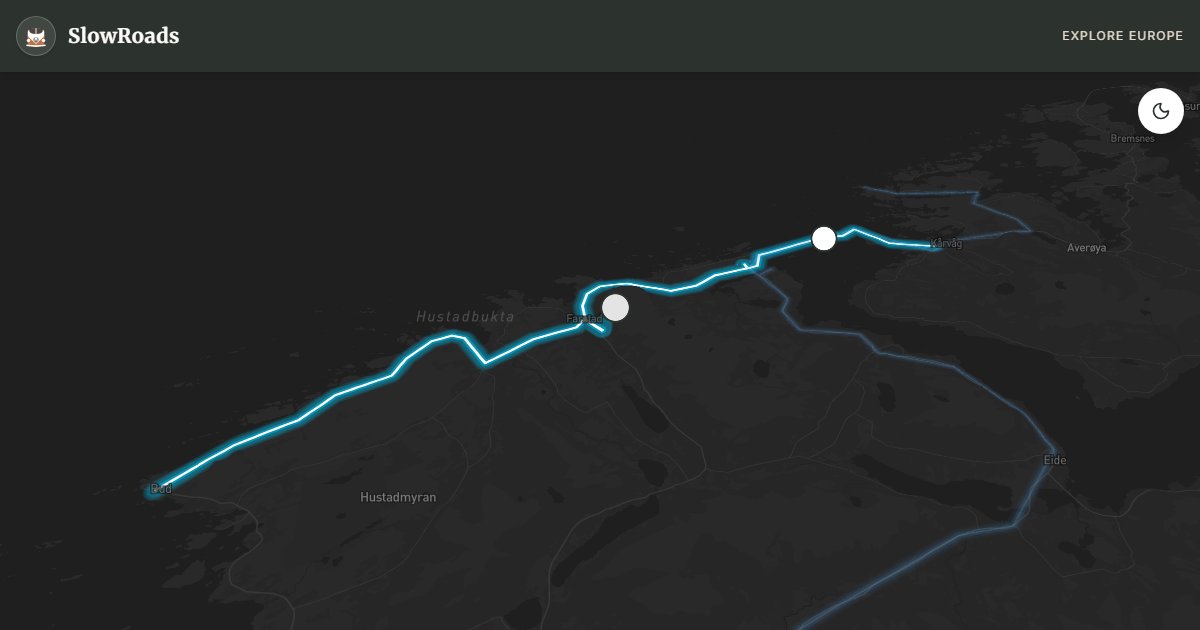
Atlanterhavsveien hops island to island on eight bridges over the Norwegian Sea — Storseisundet looks like a bridge to nowhere. Flat and open year-round, but crosswinds and storm spray challenge tall campers; classic and low-power campervans should watch forecasts and keep speeds modest. Ideal slow coastal drive from Kårvåg toward Bud with walkway stops at Eldhusøya. Toll-free since 1999. A short, iconic Nasjonal Turistveg stage — Atlantic drama without a mountain pass, but respect the weather. Allow extra time for photo pullouts, fuel stops, and cooling breaks in older vans.
Detailed Route Guide
The Atlantic Road — Atlanterhavsveien — is one of those rare places where human engineering and raw nature exist in a state of permanent tension. Built between 1983 and 1989 and running 8.3 kilometres through what are now Hustadvika (formerly Eide) and Averøy municipalities of Møre og Romsdal county, the road was opened in 1989 after years of controversial construction battered by Atlantic storms. Workers endured 12 severe Atlantic storms during the build. Today, it is a Norwegian Scenic Route and was voted Norwegian Construction of the Century — titles that begin to explain why travellers come from across the world to drive a road that is, on paper, just 36 kilometres from Kårvåg to Bud. The surrounding landscape is low, coastal, and wind-scoured: small islands, skerries, and open water stretching endlessly to the west. It feels like the edge of the known world.
The centrepiece of the Atlantic Road is the Storseisundet Bridge, the longest of the eight bridges on the route. Its curved deck rises and dips in a way that, from the right angle, makes it look as though the road simply ends in mid-air over the ocean — a genuine optical illusion that has made it one of the most photographed bridges on earth. But the Storseisundet is more than a photograph. Driving over it on a calm day is a quietly surreal experience: the sea is around you, below you, and on a clear day the Romsdal Alps rise behind you. On a storm day, it is something altogether more intense. Norway's Atlantic coast can summon waves that break entirely over the road surface; several viewing areas have been purpose-built so people can safely watch the spectacle without being on the road itself. Timing your visit around an incoming Atlantic low is, for many, the entire point.
For drivers of older, low-power campervans and classic campers — the Atlantic Road is a genuine gift. The route itself is nearly flat, with no meaningful climbs and no hairpin bends. The challenge here is not mechanical but meteorological. Crosswinds on exposed bridges can be fierce enough to push a tall van sideways, and the surface can be wet even when it hasn't rained, from sea spray alone. Drive at your own unhurried pace, pull into the parking bays, and let the ocean do the talking. The road is accessible all year round, and unlike Norway's mountain passes, it never closes for snow. This makes it an ideal late autumn or even winter destination for van travellers willing to accept the grey, storm-lit version of the scenery — which many argue is the best version.
Seasonally, the choice is yours but each season delivers something different. June and July bring the long Nordic evenings, golden light on the water, and tourist traffic that peaks but never overwhelms. August is warm and the light is softer, beginning to turn autumnal by the month's end. September and October bring dramatic storm skies and the first hints of the Northern Lights after dark. Winter is quiet, cold, and magnificent — the road stays open, the sea is dark and wild, and the villages of Bud and Kårvåg take on a stillness that feels genuinely remote. Allow a full day for the route even though the drive itself is short: the fishing village of Bud at the southern end dates to the 14th century, the viewpoints reward slow exploration, and more than once you'll stop the van just to stand at the water's edge and listen.
Frequently Asked Questions
Points of Interest
Storseisundet Bridge
Monument
The largest of the eight bridges, known for its cantilever design that creates an optical illusion of a 'bridge to nowhere'.
Askevågen Viewpoint
Nature
A glass-walled platform offering a 360-degree view of the ocean, the archipelago, and the mountainous coastline.
Route Highlights
Route Information
Navigation
* Supported by HERE Technologies, headquartered in Amsterdam, Europe. Precise routing through all waypoints.
* Waze only navigates to the starting point. Use Google Maps for the full scenic route.
Offline GPS Navigation
Download the GPX route file to navigate offline using your favorite GPS device or app (Garmin, TomTom, OsmAnd, Gaia GPS).
Ask Copilot (AI Travel Guide)
Hello! I am your SlowRoads Copilot. I know the The Atlantic Road intimately. Ask me about scenic viewpoints, local history, hidden culinary gems, or the best camper spots along the way!