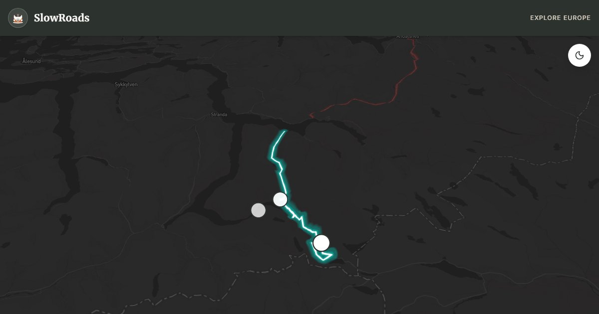
About This Route
Ørnevegen drops into UNESCO Geirangerfjord via eleven hairpins toward the Seven Sisters, then climbs to Dalsnibba's skywalk. Sustained ~10% grades demand engine braking and cooling stops in loaded classic and low-power campervans. Pair with the Eidsdal–Linge ferry. Length limits apply on the Eagle Road — van-based campers are typically fine; check vegvesen.no. Summer coaches pack the viewpoints — arrive early. A steep fjord classic that rewards patience and mechanical care. WARNING: Sustained ~10% grades; length limits; ferry timing. Allow extra time for photo pullouts, fuel stops, and cooling breaks in older vans.
Detailed Route Guide
Few places in Europe can produce the effect that the Geirangerfjord route creates at its climax. You are standing at the Ørnesvingen viewpoint at the top of the Eagle Road — Ørnevegen — looking down through eleven hairpin bends that drop 620 metres to a narrow ribbon of emerald water below. On the far side of the fjord, the Seven Sisters waterfalls cascade in unison down a sheer 250-metre wall of rock, and the air smells of cold water and pine. The scale is not merely large — it is the kind of scale that momentarily reorganises your sense of what landscape can be. The Geirangerfjord has been a UNESCO World Heritage Site since 2005, listed alongside the Nærøyfjord as examples of the world's finest fjord scenery. The designation was not controversial. One look explains everything.
The route begins at Eidsdal on the northern shore of the Norddalsfjord, where a short car ferry crosses to Linge (an atmospheric five-minute crossing that is itself part of the experience). From there, the Ørnevegen climbs immediately and dramatically, eleven switchbacks cut into the mountainside with precipitous drops on the outside edge and walls of rock on the inside. This is not a road that eases you in — by the second hairpin you are already looking down at the fjord far below. The descent from the viewpoint at the top takes you down into Geiranger village itself, a tiny settlement of around 260 permanent residents that swells to tens of thousands of visitors in summer and receives some of the world's largest cruise ships in its narrow harbour. From Geiranger, the route continues to climb the other side of the valley to the Dalsnibba plateau and the Geiranger Skywalk at 1,500 metres — the highest fjord view accessible by paved road in all of Europe.
For a classic or low-power campervan, this route represents perhaps the most demanding combination in Norway: steep descents and ascents, extended sections at 10% gradient, and the logistical complexity of the ferry crossing. The Ørnevegen descent from Eidsdal into Geiranger is arguably the most critical section — continuous 10% gradient over eight kilometres with no flat relief between hairpins demands complete respect for your brakes. Do not use the brake pedal continuously; instead use engine braking in first or second gear and apply the brakes only for hairpin approach speed control. Check your brake fluid before the route and carry a spare. The subsequent climb from Geiranger to Dalsnibba (another 8 kilometres at sustained gradient) will stress the cooling system. Stop at every possible point. The descent from Dalsnibba afterwards is equally serious. This route is achievable in a well-maintained classic or low-power camper but requires honest mechanical preparation and a cool head.
Seasonally, Geiranger is at its most spectacular in late June and September. July and August are the absolute peak of Norwegian tourism: cruise ships fill the fjord, coaches queue on the hairpins, and every parking spot requires patience. The scenery is identical but the atmosphere is very different. Come in June when the waterfalls are at maximum flow from snowmelt, the light is extraordinary (approaching Midnight Sun latitude here), and the crowds are a fraction of midsummer. September offers quieter roads, golden light, and the first hints of autumn colour on the valley slopes. The Geiranger–Trollstigen National Scenic Route combining this route with Trollstigen to the north is one of Norway's great multi-day drives — allow two full days and enjoy every hairpin.
Frequently Asked Questions
Points of Interest
Ørnesvingen Viewpoint
Nature
Located at the highest hairpin of the Eagle Road, providing a sheer drop view into the emerald Geirangerfjord.
Geiranger Skywalk (Dalsnibba)
Nature
Europe's highest fjord view from a paved road. On clear days, you can see the fjord and the glaciers far below.
Seven Sisters Waterfalls
Nature
Seven dramatic waterfalls cascading down the steep mountain side directly into the fjord.
Route Highlights
Route Information
Navigation
* Supported by HERE Technologies, headquartered in Amsterdam, Europe. Precise routing through all waypoints.
* Waze only navigates to the starting point. Use Google Maps for the full scenic route.
Offline GPS Navigation
Download the GPX route file to navigate offline using your favorite GPS device or app (Garmin, TomTom, OsmAnd, Gaia GPS).
Ask Copilot (AI Travel Guide)
Hello! I am your SlowRoads Copilot. I know the Geirangerfjord & Eagle Road intimately. Ask me about scenic viewpoints, local history, hidden culinary gems, or the best camper spots along the way!