About This Route
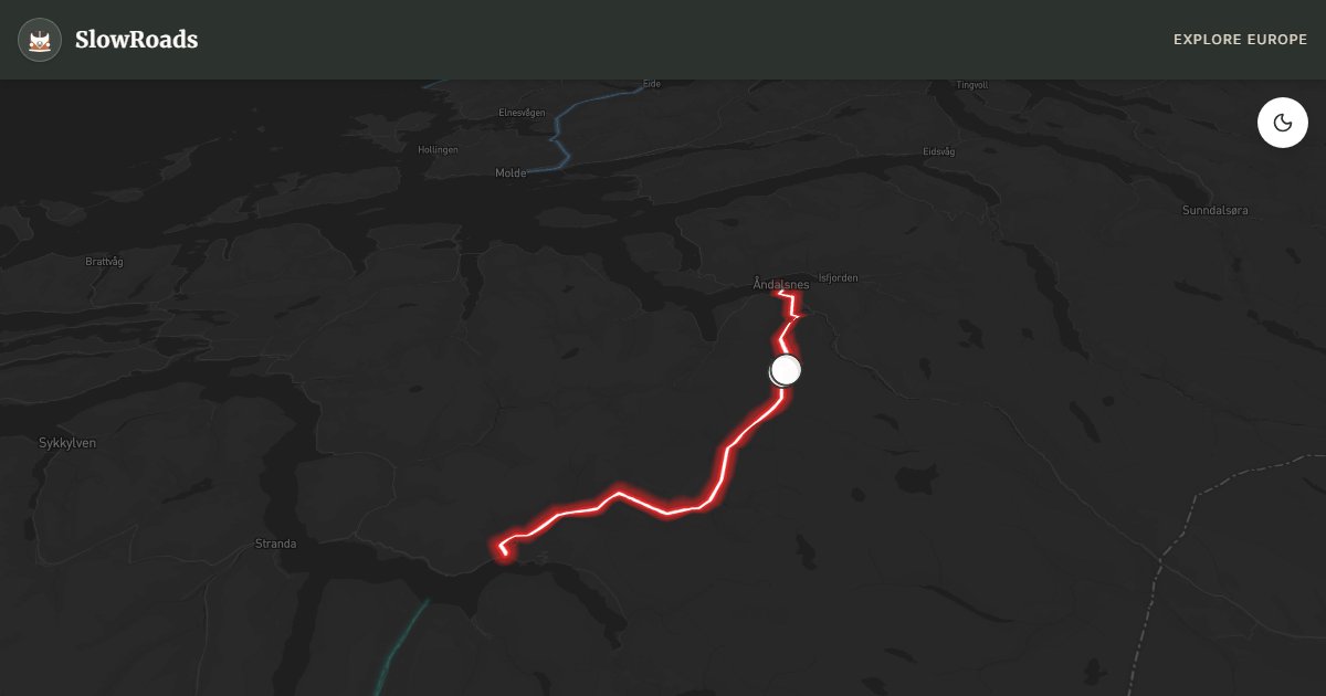
Eleven hairpins climb past Stigfossen to 858 m on Norway's most famous tourist road. Steep, narrow, and winter-closed — a serious cooling and brake test for older, low-power campervans. Open roughly June–October between Åndalsnes and Valldal. Vehicles over 12.4 m are prohibited; van-based campers are fine. Climb early, use low gears, and stop only in marked bays. A bucket-list Nasjonal Turistveg day that demands mechanical respect. WARNING: Steep, seasonal, length-limited — prepare cooling and brakes. Allow extra time for photo pullouts, fuel stops, and cooling breaks in older vans.
Detailed Route Guide
Trollstigen — literally "the Trolls' Path" — is not a road you stumble upon. It is a destination unto itself, a deliberate act of vertical audacity carved into the mountains of Møre og Romsdal between 1928 and 1936 by workers who blasted through sheer cliff faces with hand tools and dynamite. The result is eleven hairpin bends rising 858 metres over just 8 kilometres of road, an average gradient of 9% with sections touching 12%. The Stigfossen waterfall, a spectacular 320-metre cascade, falls alongside and sometimes across the road, feeding the Istra river below. King Haakon VII opened the road in 1936, and it has been Norway's most dramatic alpine drive ever since. The Trollstigen National Tourist Route designation reflects its world-class status, and the visitor centre at the top — perched on the cliff edge with cantilevered walkways over the valley — was nominated for the EU Mies van der Rohe Award for architecture.
The road connects Åndalsnes in the north with Valldal in the south, serving as a key link in the circular tourist loop through the Romsdal region. But nobody drives Trollstigen for efficiency. You drive it for the hairpins, for the waterfall that drenches your windscreen, for the moment the valley floor drops away below you and the scale of what you're doing becomes real. Each switchback is narrow — barely wide enough for two small vehicles to pass with care — and the stone walls on the outside edge feel both reassuringly solid and, when you look down, entirely inadequate. The views from each successive hairpin accumulate like a crescendo: valley, river, village, fjord, mountain, sky, repeating and expanding until you reach the top and the full panorama opens.
For a classic or low-power campervan, Trollstigen is a serious undertaking that demands honest mechanical preparation before you attempt it. The sustained 9–12% gradient will push your engine's cooling system to its absolute limit. An overheating engine mid-climb is not just inconvenient — it is dangerous on a road where stopping is difficult and reversing is near-impossible in places. The advice of experienced classic-van drivers is consistent: drive up very slowly (first or second gear throughout), stop at every available pullout to let the engine breathe, carry extra coolant, and ideally choose a cool-weather day. Driving down requires equal respect for the brakes — use engine braking in low gears and do not ride the brake pedal continuously. Caravans and motorhomes over 12.4 metres are prohibited. For those with a well-maintained van and the patience to take it slowly, the sense of achievement at the top is immense.
The road is typically closed from October to late May, sometimes into June depending on snowfall. Peak season is July and August when tourist coaches navigate the hairpins alongside campervans and cyclists. For van travellers, late June or early September offers the best balance: the road is open, the light is extraordinary, and the crowds are manageable. Tent camping under allemannsretten is possible in the valleys below on both the Åndalsnes and Valldal sides; campervans overnight only where parking is legal. Åndalsnes has full services including a supermarket and campsite with electrical hookups. Give yourself a full day: climb Trollstigen, walk the visitor centre platforms, and then descend slowly to the valley, stopping at each hairpin to look back at where you've been.
Frequently Asked Questions
Points of Interest
Trollstigen Viewpoint
Nature
A breathtaking architectural platform overhanging the valley, offering a bird's eye view of the 11 hairpin bends.
Stigfossen Waterfall
Nature
A massive 320m waterfall that the road literally crosses via a narrow stone bridge.
Route Highlights
Route Information
Navigation
* Supported by HERE Technologies, headquartered in Amsterdam, Europe. Precise routing through all waypoints.
* Waze only navigates to the starting point. Use Google Maps for the full scenic route.
Offline GPS Navigation
Download the GPX route file to navigate offline using your favorite GPS device or app (Garmin, TomTom, OsmAnd, Gaia GPS).
Ask Copilot (AI Travel Guide)
Hello! I am your SlowRoads Copilot. I know the Trollstigen (The Trolls' Path) intimately. Ask me about scenic viewpoints, local history, hidden culinary gems, or the best camper spots along the way!