About This Route
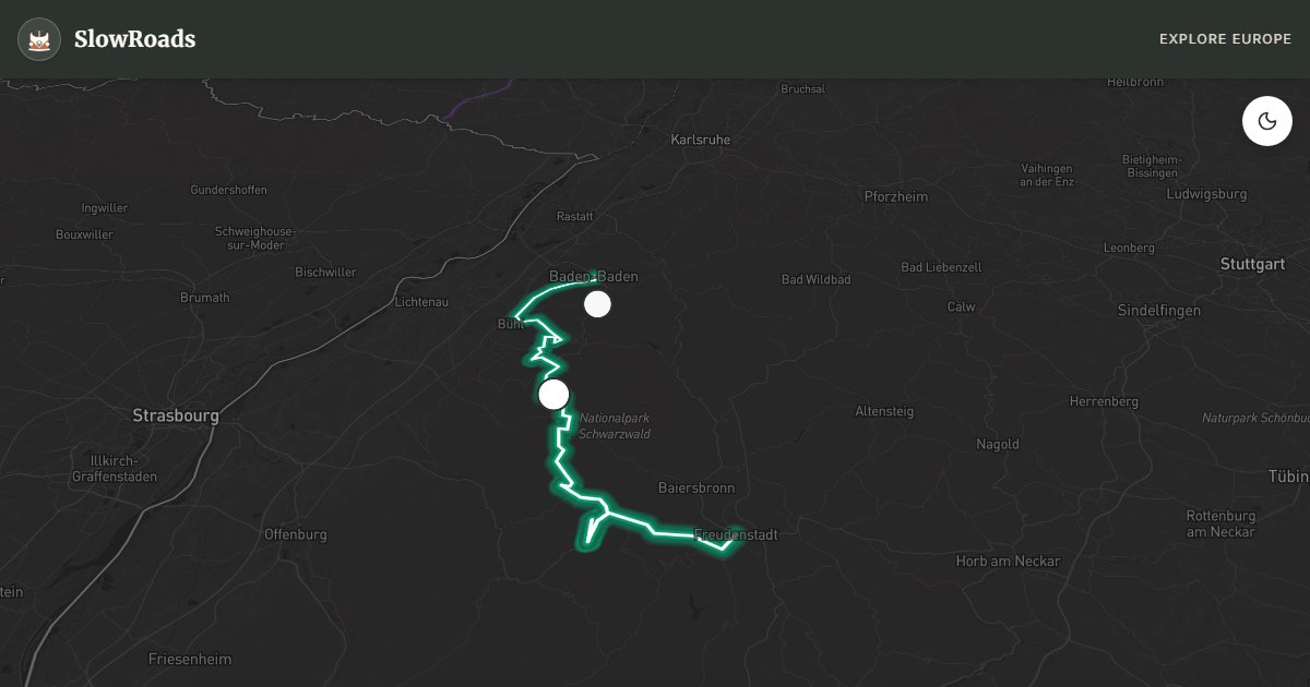
Drive the Black Forest High Road (B500) from Baden-Baden to Freudenstadt: Rhine-plain views, Mummelsee, and fir-ridge cruising on one of Germany’s classic short mountain drives. The valley-to-ridge climb rewards cooling stops and low gears in older or low-power campervans; descents need engine braking with a loaded van. Snow can linger on high sections into spring — late May to October is the reliable window. Fuel before long forest loops, use marked Stellplätze rather than roadside overnighting, and expect weekend motorcycle traffic on clear days. Compact distance, big atmosphere.
Detailed Route Guide
The Black Forest High Road — the B500 — is one of Germany's great ridge drives. Rising from Baden-Baden's elegant spa resort through dense fir forest to a plateau at around 1,000 metres, this 73-kilometre route was built in the 1920s as a scenic panorama road and immediately became famous for the views it offers across the Rhine plain to the Vosges Mountains of France. On a clear day the straight-line distance visible from the ridge is extraordinary — the kind of vantage point that requires no explanation of why someone would build a road here.
Baden-Baden itself is a worthy starting point. This spa town of extraordinary elegance — favoured by Russian aristocracy and European royalty throughout the 19th century — has thermal baths (the Friedrichsbad is a magnificent Roman-Irish temple of steam and marble), a casino that Dostoevsky reportedly used as inspiration for 'The Gambler', and a pedestrian old town that rewards an hour of wandering. Fill up with petrol and water here before the climb.
The ascent from Baden-Baden to the ridge is the critical section. The road climbs steeply from around 200 metres to the Bühlerhöhe plateau in a relatively short distance — your engine will heat up and first or second gear is needed on the steepest sections. Coolant temperatures that might be normal in flat driving can spike here. The critical advice: do not stop your engine when it is overheating — keep it running (idling is better than off) and allow airflow. Once on the ridge, the road flattens to a genuine cruise through cathedral-like fir forest, and the engine can cool naturally.
The Mummelsee at 1,036 metres is the route's centrepiece: a small, dark-green glacial lake surrounded by forest. Legend holds that a water spirit (the Mummel) lives in its depths, and the location has an atmospheric quality that the nearby hotel-restaurant somewhat undercuts but does not eliminate. Nearby, a short walking path leads to a viewpoint over the Hornisgrinde — the highest point in the northern Black Forest at 1,163 metres — where communication towers and a clear day give views extending to the Alps.
The road continues south through Ruhestein and Allerheiligen, where the ruins of a medieval monastery sit at the head of a dramatic gorge with a series of waterfalls. This is one of the most visited natural sights in the Black Forest and a good leg-stretch stop. The final descent into Freudenstadt — a grid-planned market town built by Duke Frederick I of Württemberg in 1599 — is steep and winding. Park on the vast Marktplatz (reportedly the largest market square in Germany) and have a coffee before heading onward.
For slower vehicles, the key is preparation and patience. The climb from Baden-Baden can be done without drama if you do not rush. Carry extra coolant, allow cooling stops at the Bühlerhöhe summit and Mummelsee, and the rest of the route rewards you with one of Germany's most atmospheric forest drives. In winter, the B500 can be snow-covered and treacherous; summer mornings offer mist in the valleys below and sunshine on the ridge — a combination worth setting the alarm for.
For classic campervans, older campers, and other low-power vans, treat the Baden-Baden climb as a planned effort rather than a surprise: check coolant before you leave the spa town, use low gears without shame, and take a cooling pause at Bühlerhöhe or Mummelsee before continuing the ridge cruise. Descents into Freudenstadt need engine braking with a loaded camper. Overnight on Stellplätze or campgrounds — wild camping in the Black Forest is not generally permitted. Motorcycle traffic on sunny weekends is the main social hazard; pull over early and let faster traffic pass.
Frequently Asked Questions
Points of Interest
Mummelsee
Nature
Geroldsau Waterfall
Nature
Route Highlights
Route Information
Navigation
* Supported by HERE Technologies, headquartered in Amsterdam, Europe. Precise routing through all waypoints.
* Waze only navigates to the starting point. Use Google Maps for the full scenic route.
Offline GPS Navigation
Download the GPX route file to navigate offline using your favorite GPS device or app (Garmin, TomTom, OsmAnd, Gaia GPS).
Ask Copilot (AI Travel Guide)
Hello! I am your SlowRoads Copilot. I know the Black Forest High Road intimately. Ask me about scenic viewpoints, local history, hidden culinary gems, or the best camper spots along the way!