About This Route
Highland circuit through Durmitor National Park — Black Lake, Tara Canyon (widely cited as Europe's deepest), and the Đurđevića Tara bridge 172 m above the river. Roads above Žabljak reach roughly 1,700–1,907 m with steep grades and missing guardrails; snow can linger into June. Classic and low-power campervans should climb Sedlo in the cool morning, watch coolant, and engine-brake descents. Fuel and supplies in Žabljak before high loops. Wild camping officially not allowed — use Žabljak campsites and treat Durmitor as a two-day highland base.
Detailed Route Guide
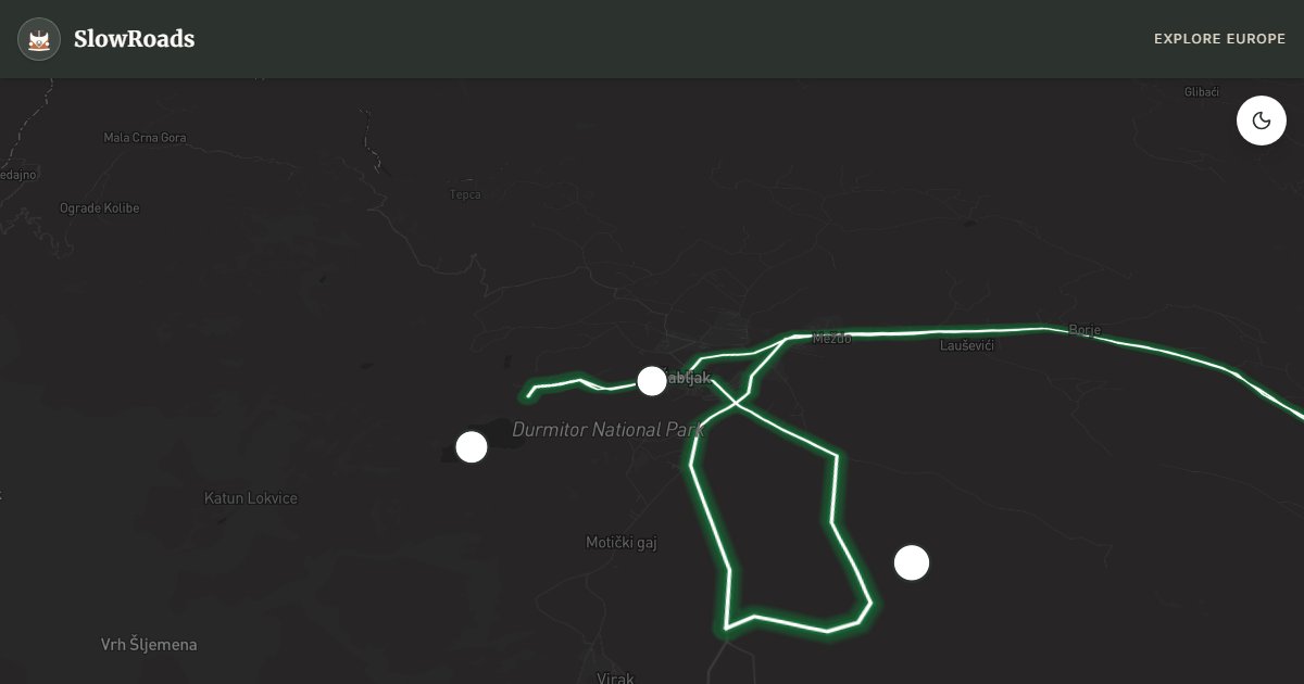
Durmitor National Park is Montenegro's mountain soul — a UNESCO World Heritage limestone massif in the country's northwest, where glacial lakes, wolf-haunted forests, and the Tara River Canyon combine into a landscape that feels more Alpine than Adriatic. The ring drive from Žabljak, roughly 116 kilometres looping through the park's interior and out to the Tara Canyon bridge, is the definitive highland route for slow van travellers who want to trade Kotor's crowds for silence, altitude, and some of the most vertiginous views in southeastern Europe.
Žabljak itself, at 1,456 metres the highest town in the Balkans, is the natural base. A small, functional mountain settlement with guesthouses, a supermarket, and several campsites (including Camp Kalica and the municipal autocamp), it sits minutes from Crno Jezero — Black Lake — the park's most accessible highlight. A flat, well-marked trail circles the glacial lake in forty-five minutes through dark pine forest, with the Bobotov Kuk peak (2,523 m, Durmitor's highest) reflected in the water on calm mornings. Arrive early; the car park fills by 10 AM in July.
From Žabljak, the P14 road south crosses the Sedlo pass at 1,907 metres — open meadows, wildflowers in June, and the possibility of seeing brown bears at dawn or dusk. The road surface is adequate but narrow, with sections lacking guardrails where the drop into side valleys is significant. For a classic or low-power campervan, the Sedlo climb is manageable in second gear on a cool morning but should not be attempted in midday heat or with an overheating engine. The reward for crossing the pass is the descent toward the Tara Canyon and the Đurđevića Tara bridge — a five-arch concrete span completed in 1940, suspended 172 metres above the Tara River. The bridge is a destination in itself: walk its length, watch rafters navigate the canyon below, or bungee jump from the centre arch in summer.
The Tara Canyon, carved up to about 1,300 metres deep over millennia, is widely cited as Europe's deepest canyon (Sulak in Russia is deeper by some measures). Viewpoints near the bridge offer perspectives that genuinely induce vertigo. White-water rafting trips depart from multiple points along the river — a full-day activity that pairs well with a two-night stay in Žabljak. The return loop to Žabljak via Mojkovac and the lower Tara valley completes the ring on quieter secondary roads.
Allow two to three days minimum. The park entrance fee is modest (€3–5 per person per day). Roads are generally open May through October; snow can block the Sedlo pass into June. Winter driving requires chains and experience. Fuel is available in Žabljak and Mojkovac — fill up before entering the park's remote sections.
Pay the park fee, fill in Žabljak, and treat Sedlo as a cool-morning climb for classic and low-power campervans. Snow can linger into June. Wild camping is officially not allowed — use Žabljak campsites. Two to three days let Black Lake, the Tara bridge, and a rafting day coexist without rushing brakes or altitude.
Frequently Asked Questions
Points of Interest
Crno Jezero (Black Lake)
Nature
Durmitor's glacial twin lakes surrounded by pine forest — a flat walk from the car park.
Đurđevića Tara Bridge
Monument
Five-arch concrete bridge, 172 m above the Tara River — bungee jumping and zip-line in season.
Tara River Canyon Viewpoint
Nature
Lookout over Europe's deepest river canyon — 1,300 m from rim to water.
Sedlo Pass
Nature
High pass at 1,907 m on the P14 road with wildflower meadows and bear habitat.
Žabljak Town
Town
Montenegro's highest town (1,456 m) — base for hiking, skiing, and park access.
Route Highlights
Route Information
Navigation
* Supported by HERE Technologies, headquartered in Amsterdam, Europe. Precise routing through all waypoints.
* Waze only navigates to the starting point. Use Google Maps for the full scenic route.
Offline GPS Navigation
Download the GPX route file to navigate offline using your favorite GPS device or app (Garmin, TomTom, OsmAnd, Gaia GPS).
Ask Copilot (AI Travel Guide)
Hello! I am your SlowRoads Copilot. I know the Durmitor Ring intimately. Ask me about scenic viewpoints, local history, hidden culinary gems, or the best camper spots along the way!