About This Route
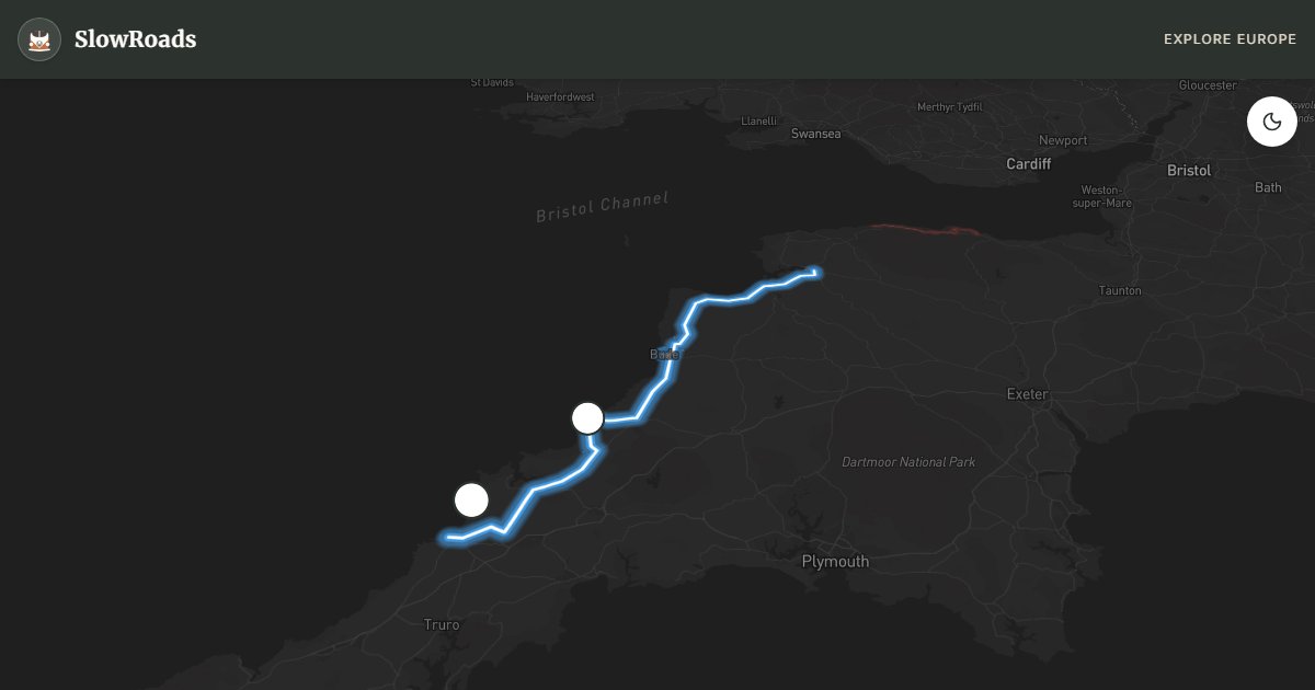
Drive the A39 Atlantic Highway from Barnstaple to Newquay along Devon's and Cornwall's north coast — cliffs, surf beaches, Tintagel Castle, and Bedruthan Steps. This working A-road suits classic campervans: moderate pace, little severe gradient, and constant Atlantic weather. Detour to Clovelly on foot (cars banned in the village), allow time for Tintagel and Boscastle, and arrive early at National Trust parking for Bedruthan. Wild camping without landowner permission is illegal — use campsites between Bude and Newquay. Plan two slow days rather than a single 127 km dash if you want viewpoints, not just mileage.
Detailed Route Guide
The Atlantic Highway — the A39 between Barnstaple and Newquay — is one of England's great coastal drives, running for 127 kilometres along the northern edges of Devon and Cornwall with the Atlantic Ocean never far from view. Unlike many designated scenic routes, the A39 is also a working road used by local traffic, which gives it an authenticity that purpose-built tourist circuits often lack. The road sweeps through market towns, fishing villages, and high moorland edges, with enough dramatic scenery, mythological resonance, and surf culture to sustain several days of unhurried exploration. For classic campervan crews with a tendency to stop at every viewpoint and investigate every side road, the Atlantic Highway is deeply rewarding.
From Barnstaple — a medieval market town and the regional centre of North Devon — the A39 heads west, quickly climbing onto the high ground above the Bristol Channel. The coast here is dramatic: high cliffs falling to rocky shores, with views across to Wales on a clear day. The village of Clovelly is a short detour from the main road: a steeply cobbled fishing village of white-washed cottages that tumbles down a cliffside to a tiny harbour, so steep that cars are banned and goods are ferried by donkey. It is undeniably touristy but genuinely unlike anywhere else in England. Further west at Bude, the A39 skirts the cliff tops before the road swings inland through Camelford and descends to the coast again near Tintagel.
Tintagel Castle is the site most associated with the legend of King Arthur — the ruins perched on a dramatic headland connected to the mainland by a narrow ridge of rock are managed by English Heritage and open to visitors. Whatever the historical truth of the Arthurian connection, the setting is extraordinary: sheer black slate cliffs, crashing Atlantic waves, and a castle that genuinely looks as if it belongs in myth. Below the castle, Merlin's Cave is accessible at low tide. The nearby village of Boscastle has a beautiful natural harbour and an excellent Museum of Witchcraft and Magic that is, despite its unusual subject matter, a serious and well-curated cultural institution.
The final section of the Atlantic Highway descends into Cornwall proper, passing Wadebridge and Padstow — the latter a small fishing town transformed by its association with celebrity chef Rick Stein into one of Cornwall's foodie epicentres — before the road ends at Newquay. Newquay is England's surf capital, and the broad, west-facing Fistral Beach is one of the finest surf breaks in the country. For non-surfers, Bedruthan Steps — a National Trust beach north of Newquay where giant sea stacks rise from the sand — is one of the most spectacular coastal landscapes on the entire Atlantic seaboard. A classic campervan parked in the National Trust car park and a short cliff-path walk delivers views that feel genuinely wild and untouched.
Expect changeable Atlantic weather even in summer: fog can erase cliff views within minutes, and strong onshore winds buffet high-sided campers on exposed stretches near Bude and Newquay. Keep speeds modest, leave extra following distance, and secure roof gear before the open coastal sections. Fuel is available in Barnstaple, Bude, Wadebridge, and Newquay — fill before the quieter Tintagel–Boscastle stretch if your tank is low. Wild camping without landowner permission remains illegal here as elsewhere in England; coastal car parks are often patrolled or closed overnight, so plan campsites between Bude and Tintagel or near Newquay rather than improvising on cliff-top lay-bys. One slow day for the Devon half and one for Cornwall keeps the trip enjoyable in a low-power van.
Frequently Asked Questions
Points of Interest
Tintagel Castle
Castle
Arthurian headland ruins — English Heritage
Bedruthan Steps
Nature
Sea stacks north of Newquay — arrive early
Clovelly
Town
Steep cobbled village — cars banned; park above
Route Highlights
Route Information
Navigation
* Supported by HERE Technologies, headquartered in Amsterdam, Europe. Precise routing through all waypoints.
* Waze only navigates to the starting point. Use Google Maps for the full scenic route.
Offline GPS Navigation
Download the GPX route file to navigate offline using your favorite GPS device or app (Garmin, TomTom, OsmAnd, Gaia GPS).
Ask Copilot (AI Travel Guide)
Hello! I am your SlowRoads Copilot. I know the Atlantic Highway A39 (Devon–Cornwall) intimately. Ask me about scenic viewpoints, local history, hidden culinary gems, or the best camper spots along the way!