About This Route
Porlock Hill to Lynton — high moorland, red deer, and the steepest A-road climb in England.
Detailed Route Guide
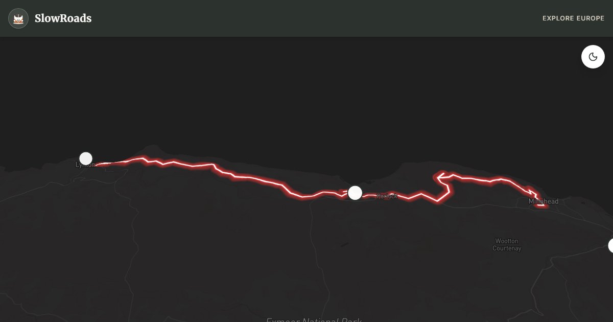
Fifty-five kilometres from Minehead to Lynton climb from the Bristol Channel into Exmoor National Park — the last substantial wilderness in southwest England, where red deer graze open moorland and the A39 tests every underpowered engine on its way to the coast. The route passes Dunster, a medieval village crowned by a National Trust castle with a working watermill below the hill, before confronting Porlock Hill, a one-in-four gradient over two kilometres that ranks as the steepest classified A-road climb in England. Beyond Porlock, the coast road threads between oak woodland and sea cliffs toward Lynton and Lynmouth, twin villages linked by a Victorian water-powered cliff railway that still carries passengers between the two settlements. Allow one to two days: rushing this landscape defeats the point of driving it at all.
Dunster Castle overlooks a yarn-market town unchanged since the Middle Ages — visit in May when rhododendrons fill the terraced gardens and the High Street's timber-framed shops sell local wool. Porlock Hill demands mechanical respect from every T3 driver: first or second gear on the ascent without riding the clutch, engine braking on the descent, and a willingness to pull over at the summit if coolant temperature rises on a warm afternoon. At the top, views open across the Bristol Channel to the Welsh coast on clear days. The Valley of Rocks, just west of Lynton, is a geological anomaly — a dry valley lined with weathered tors where feral goats clamber on Devonian cliffs above the sea, and the South West Coast Path runs along the ridge. Dusk on Exmoor moorland is prime time for spotting red deer herds silhouetted against the sky above the heather.
Campervan planning should account for Porlock Hill's severity. Porlock Caravan Park before the climb is the sensible overnight choice — attempting the hill with a fully loaded T3 at day's end when brakes are warm invites trouble that recovery services know well. Minehead offers overflow parking near Butlins with variable signage; Lynton camping sits above the cliff railway with level pitches suited to older vans. Exmoor National Park restricts roadside overnighting on open moorland — stick to designated sites and respect gate closures on unfenced common land. After rain, the A39 descent toward Lynmouth is slick on cambered corners; keep speed low and avoid riding the brakes for the full two-kilometre drop.
May pairs rhododendrons at Dunster with foals on the moor and longer daylight for deer watching. September brings misty mornings in the Valley of Rocks without summer coach traffic queuing at Porlock Hill's hairpin bends. Winter snow can close moorland roads above 300 metres — check Exmoor National Park alerts before departure and carry chains if forecasts turn. One day covers Minehead to Porlock and Dunster; add a second for Porlock Hill, Valley of Rocks, and Lynton at an unhurried pace that lets the moor breathe.
Frequently Asked Questions
Points of Interest
Porlock Hill
Nature
1-in-4 gradient A-road
Valley of Rocks
Nature
Geological wonder near Lynton
Dunster Castle
Castle
National Trust hilltop castle
Route Highlights
Route Information
* Waze only navigates to the starting point. Use Google Maps for the full scenic route.
Ask Copilot (AI Travel Guide)
Hello! I am your SlowRoads Copilot. I know the Exmoor & North Devon Coast intimately. Ask me about scenic viewpoints, local history, hidden culinary gems, or the best camper spots along the way!