About This Route
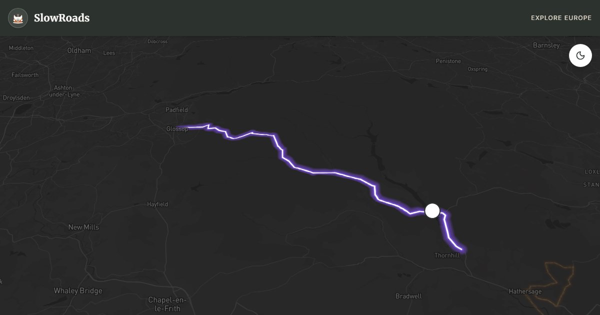
Snake Pass (A57) crosses Peak District Dark Peak moorland from Glossop to Bamford and Ladybower Reservoir — famous Pennine curves, 512 m summit, and frequent winter closures. Ideal drama-per-kilometre for classic campervans when the road is open: steep but steady gradients, good surface, bleak gritstone views. Named for the Duke of Norfolk's crest, not the bends. Check Derbyshire closures November–April before you leave. Wild camping without permission is illegal — overnight in Hope Valley campsites, not summit lay-bys. Pair with Woodhead or Hope Valley for a full Dark Peak day.
Detailed Route Guide
The Snake Pass — the A57 between Glossop and Bamford — is perhaps the most famous driving road in the English Midlands, a 24-kilometre crossing of the Dark Peak section of the Pennines that threads between Manchester to the west and Sheffield to the east. Its name comes not from its serpentine curves, as many assume, but from the Duke of Norfolk's family crest (a snake), who funded the original turnpike road in 1821. In practice, the name suits the road perfectly: it twists and undulates through some of the bleakest, most atmospheric moorland in England, climbing to 512 metres before descending through the dramatic Woodlands Valley to the Ladybower Reservoir. For anyone who loves driving roads with character and landscape with gravitas, the Snake Pass is essential.
The approach from Glossop — a market town on the western edge of the Peak District that retains a pleasantly unreconstructed character — immediately leaves the urban fringe behind and climbs onto open moorland within minutes. The Pennine moors here are vast and treeless, broken only by peat bogs, gritstone outcrops, and the occasional footpath marker. The Pennine Way long-distance footpath crosses the Snake Pass near the summit, and walkers in waterproofs are a common sight on the road edges. The summit section at Snake Pass Inn — another high-altitude pub, and one of the highest on any A-road in England — offers a bleak, windswept beauty that has its own distinct appeal.
The eastern descent into Bamford is where the landscape transforms. As the road drops through the Woodlands Valley, the dark gritstone cliffs of Alport Castles appear to the left (a remarkable natural landslip feature, accessible by footpath), and the valley floor narrows to the serpentine curves that are the road's most photographed sections. At the bottom, the Ladybower Reservoir opens up — a vast Y-shaped reservoir created in the 1940s whose construction flooded two villages (Derwent and Ashopton). The stone towers of the original Derwent Dam emerge from the water in drought years, and this area is also famous as the training ground for the Dam Busters squadron in World War II.
For classic campervan drivers, the Snake Pass is ideal territory: the gradients are steep but not savage, the road surface is generally good, and the drama-to-kilometre ratio is exceptionally high. The pass is frequently closed in winter due to snow and ice — sometimes for weeks at a time — making it a genuinely seasonal experience. Late spring and autumn are perfect: the moorland colours shift from purple heather to tawny bracken, and the low light across the open fell is extraordinary. A classic campervan parked at the summit near Snake Pass Inn with a thermos of coffee and the wind across the moors is a deeply satisfying form of travel.
Treat the Snake Pass as a weather-dependent road, not a guaranteed shortcut between Manchester and Sheffield. In winter, check Derbyshire and Highways England updates before leaving Glossop; when the pass is closed, do not attempt farm tracks or ungritted alternatives in a classic campervan. In clear weather the summit pull-offs are excellent thermos stops — keep wheels fully off the carriageway and watch for walkers crossing to the Pennine Way. Combine with Ladybower's shoreline roads for a half-day loop, then overnight at a campsite in the Hope Valley rather than at informal lay-bys. Wild camping without permission is illegal; the Dark Peak is heavily monitored around reservoirs and popular edges.
Frequently Asked Questions
Points of Interest
Ladybower Reservoir
Nature
Y-shaped reservoir — flooded Derwent & Ashopton
Snake Pass Summit
Nature
512 m Dark Peak crossing — check winter closures
Route Highlights
Route Information
Navigation
* Supported by HERE Technologies, headquartered in Amsterdam, Europe. Precise routing through all waypoints.
* Waze only navigates to the starting point. Use Google Maps for the full scenic route.
Offline GPS Navigation
Download the GPX route file to navigate offline using your favorite GPS device or app (Garmin, TomTom, OsmAnd, Gaia GPS).
Ask Copilot (AI Travel Guide)
Hello! I am your SlowRoads Copilot. I know the Snake Pass (Peak District) intimately. Ask me about scenic viewpoints, local history, hidden culinary gems, or the best camper spots along the way!