South Coast Waterfalls & Black Sand
About This Route
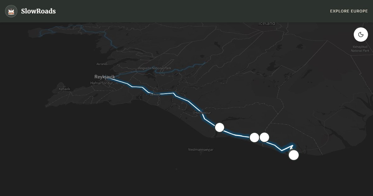
Classic Route 1 from Reykjavik to Vík: Seljalandsfoss, Skógafoss, Reynisfjara black beach, Dyrhólaey cliffs, and Sólheimajökull glacier tongue — paved and flat for classic and low-power campervans. Never turn your back on the ocean at Reynisfjara — sneaker waves kill; respect rope lines. Coastal wind can exceed 25 m/s and shove high vans on open stretches. Camp at Skógar or Vík; wild camping needs landowner permission. Fill fuel before the open plain and allow a full day so waterfall stops are rests, not rushes.
Detailed Route Guide
Iceland's south coast is the country's most photographed driving corridor — a straight shot along Route 1 from Reykjavik to the village of Vík í Mýrdal, roughly 199 kilometres of waterfall-draped cliffs, glacier tongues, and black volcanic beaches facing the North Atlantic. The road is paved throughout and passes beneath the Eyjafjallajökull and Mýrdalsjökull ice caps, whose meltwater feeds the cascades that tumble directly beside the asphalt. For slow van travellers, this is Iceland at its most accessible and most dramatic simultaneously.
Seljalandsfoss appears first — a slender 60-metre fall that you can walk behind on a marked trail, emerging soaked but exhilarated on the far side. Skógafoss follows, wider and louder, with a staircase climbing to a viewpoint above the mist. Between the two, optional detours lead to hidden falls in the Skógar gorge and to the Sólheimajökull glacier tongue, where guided ice walks depart from a car park that fills by mid-morning in summer.
The coast darkens as you approach Vík. Reynisfjara beach is Iceland's most famous black sand shore — hexagonal basalt columns rise from the surf like organ pipes, and offshore sea stacks (Reynisdrangar) stand like sentinels in the grey water. This beach has a lethal reputation: sneaker waves — sudden surges that run far up the shore without warning — have killed tourists who turned their backs to photograph the scenery. Stay well above the wet sand line and never enter the water. Dyrhólaey headland, a few kilometres west, offers a natural stone arch and, from May to August, one of Iceland's largest puffin colonies.
For classic and low-power campervans, the south coast is entirely manageable on Route 1 — no F-roads required unless you choose glacier side roads. Fuel and supplies are available in Hvolsvöllur and Vík; fill up before continuing east. Wind is the primary hazard: the coastal plain funnels Atlantic gales, and gusts exceeding 25 m/s can make driving a high-sided van genuinely difficult. Hold the wheel firmly, reduce speed, and consider waiting out severe weather in Vík's campsite or one of the farm-stay parking areas. June through August is peak season; May and September offer fewer coaches and softer light. Allow two days if you want to hike Skógar's waterfall trail or join a glacier walk.
Build the day around weather and wind, not kilometre targets. Fill fuel in Hvolsvöllur before the open coastal plain, and again in Vík before continuing east. Campsites at Skógar and Vík are the reliable overnight bases; wild camping still needs landowner permission — a black-sand pull-off is not a campsite. If gusts exceed what feels safe for a high-sided classic camper, wait them out rather than fighting the Atlantic on Route 1. Allow a second day for Skógar’s waterfall trail or a guided glacier walk at Sólheimajökull so the south coast is more than a waterfall checklist between Reykjavik and Vík.
Reynisfjara's sneaker-wave warnings are not theatre — stay above the wet sand and never turn your back on the Atlantic. Dyrhólaey's puffin season (roughly May to mid-August) rewards early or late visits when coaches thin out. Classic and low-power campervans belong on Route 1 here: the drama is geological and meteorological, not mechanical, as long as you respect wind and overnight legality.
Frequently Asked Questions
Points of Interest
Seljalandsfoss
Nature
Walk behind this 60-metre curtain of water on a marked trail.
Skógafoss
Nature
A 25-metre-wide, 60-metre-high fall with a staircase to the top.
Reynisfjara Black Beach
Nature
Basalt columns and black volcanic sand — respect the warning signs about waves.
Dyrhólaey Arch
Nature
A natural stone arch and puffin colony (May–August) overlooking the coast.
Sólheimajökull Glacier
Nature
A retreating glacier tongue visible from the road with guided walk options.
Route Highlights
Route Information
Navigation
* Supported by HERE Technologies, headquartered in Amsterdam, Europe. Precise routing through all waypoints.
* Waze only navigates to the starting point. Use Google Maps for the full scenic route.
Offline GPS Navigation
Download the GPX route file to navigate offline using your favorite GPS device or app (Garmin, TomTom, OsmAnd, Gaia GPS).
Ask Copilot (AI Travel Guide)
Hello! I am your SlowRoads Copilot. I know the South Coast Waterfalls & Black Sand intimately. Ask me about scenic viewpoints, local history, hidden culinary gems, or the best camper spots along the way!