About This Route
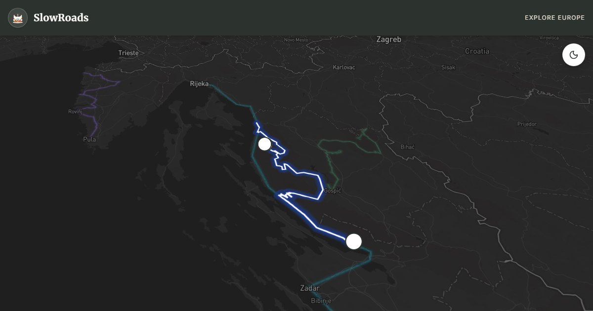
Wild limestone Velebit: North Velebit National Park and Paklenica gorges inland from the Adriatic — steeper, emptier roads than the D8 for patient classic and low-power campervans. Cool engines on climbs; Bura wind can close coastal links with little warning. Autokamp near Starigrad-Paklenica; no wild camping inside the parks. Best late spring and early autumn when heat and crowds ease on the karst. Fill fuel before empty highland stretches and treat gorge trailheads as walk-ins from signed parking, not overnight pitches.
Detailed Route Guide
If the Adriatic Highway is Croatia's greatest coastal spectacle, the Velebit range is its wild heart. Croatia's largest mountain system — a UNESCO Biosphere Reserve running 145 kilometres parallel to the coast — rises so abruptly from the Adriatic that it creates one of the most extreme topographic contrasts in Europe: the coast below is Mediterranean, sun-baked and fragrant with lavender; the plateau above is sub-alpine, swept by the Bora wind and home to bears, lynx, and wolf packs. The route from Senj through North Velebit National Park to Starigrad-Paklenica covers 178 kilometres of roads that most coastal visitors never see, and the solitude and wildness are extraordinary.
Senj is the gateway and deserves a stop before the climb begins. The Uskoks — fierce pirates who operated from this fortified town throughout the sixteenth and seventeenth centuries, raiding Ottoman and Venetian ships — left a legacy of walls, towers, and a museum that makes the town far more interesting than it appears from the main road. Then the climb begins. The road into North Velebit National Park winds steeply upward through beech and black pine forest, crossing the Velebit plateau near the Zavižan meteorological station at 1,594 metres — the highest permanently staffed weather station in Croatia. The Zavižan botanical garden, maintained since 1967, displays over 300 plant species endemic to the Velebit range. On clear days the view from the summit ridge takes in the islands of Pag, Rab, and Krk and, on exceptional days, reaches the Italian coast. Bears are regularly sighted in the forest; the lynx population, reintroduced in 1973, is small and elusive but real.
The descent south toward Paklenica brings the route to its dramatic conclusion. Paklenica National Park contains two parallel limestone gorges — Velika Paklenica (Big Paklenica, 14 km long) and Mala Paklenica (Small Paklenica, 7 km) — carved by meltwater through the Velebit massif. The gorge walls rise 400 metres and are textured with 400 documented climbing routes that make Paklenica one of the most significant rock climbing destinations in the Mediterranean. The lower gorge is accessible on foot: a path follows the Velika Paklenica stream through the canyon to a wartime partizan cave hospital (built 1942–1944) and further to the alpine huts near the summit.
For a classic or low-power campervan this route demands respect and preparation. The mountain roads are narrow, steep in sections, and entirely unpaved for some stretches — check your tyres and brakes before Senj. The Bora wind that channels through the Velebit passes can reach hurricane force (over 200 km/h has been recorded at Zavižan) and can make driving dangerous with a high-sided vehicle; check forecasts carefully. Fuel up fully in Senj — there are no petrol stations on the plateau. The reward for all this preparation is a drive that feels utterly removed from the tourist Croatia of the coast: just white limestone, dark forest, the smell of mountain herbs, and the sense that the land is still genuinely wild.
Frequently Asked Questions
Points of Interest
North Velebit Viewpoint
Nature
Zavižan Weather Station
Nature
Paklenica Gorges
Nature
Route Highlights
Route Information
Navigation
* Supported by HERE Technologies, headquartered in Amsterdam, Europe. Precise routing through all waypoints.
* Waze only navigates to the starting point. Use Google Maps for the full scenic route.
Offline GPS Navigation
Download the GPX route file to navigate offline using your favorite GPS device or app (Garmin, TomTom, OsmAnd, Gaia GPS).
Ask Copilot (AI Travel Guide)
Hello! I am your SlowRoads Copilot. I know the Velebit Nature Route intimately. Ask me about scenic viewpoints, local history, hidden culinary gems, or the best camper spots along the way!