About This Route
The Eysturoyartunnilin experience: an 11 km undersea link with the world's first undersea roundabout joining Runavík, Strendur, and Hvalvík — modern Faroese engineering under the fjord. Toll is payable online or at a kiosk; the two-lane tunnel suits all classic and low-power campervans without height drama. Approach roads on Eysturoy stay wind-exposed; weather often closes the old mountain alternative (Route 594). Use the tunnel as a calm connector between villages, not a race. Fuel and overnight on either shore at campsites — plan around Atlantic fronts that still rule the surface roads.
Detailed Route Guide
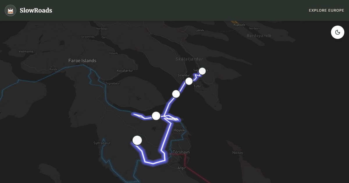
The Eysturoy subsea tunnel route is engineering tourism at its most dramatic — the Eysturoyartunnilin, opened in December 2020, burrows 11 kilometres beneath the fjord at depths up to about 189 metres, connecting Runavík on Eysturoy to Hvalvík on Streymoy via the world's first undersea roundabout. For slow van travellers, this 33-kilometre route is less about the driving (the tunnel itself is two-lane, well-lit, and van-friendly) and more about understanding how tunnel infrastructure has replaced weather-vulnerable mountain roads across the archipelago.
Runavík provides the eastern portal — a working fishing harbour with the toll payment kiosk (online registration at tunnil.fo is cheaper than drive-up rates). The tunnel descent is smooth and two-laned; the undersea roundabout appears as an illuminated junction about 73 metres below the fjord surface with three branches — take the correct exit for Strendur, Hvalvík, or the return loop. Height limit 4.2 metres; all vans pass comfortably.
The approach roads on Eysturoy above the tunnel portals are the real challenge — exposed ridge roads where Atlantic wind gusts regularly exceed 25 m/s and Landsverk closes Route 594 (the old mountain road) frequently in storm warnings. A high-sided campervan should slow to a crawl in crosswinds on the Strendur approach; sudden gusts from fjord gaps are unpredictable. Weather closures affect the old road more than the tunnel — the tunnel stays open in most conditions, but surface approach roads can ice in winter.
For classic and low-power campervan drivers, budget the toll (approximately 75–125 DKK depending on route and payment method), keep headlights on throughout, and check tunnil.fo for rates before departure. The route pairs naturally with the main islands loop and the Gjógv northern extension. Visit year-round — the tunnel operates 24 hours — but approach road conditions vary dramatically by season. Summer offers calmer winds; winter demands daily weather checks before committing to exposed sections.
Pay at tunnil.fo for discounts or at the kiosk by card; unregistered drive-through costs more. Height limit 4.2 m suits all classic campervans. The tunnel stays open in most weather; Route 594 mountain alternative closes often in storms. Slow to a crawl in crosswinds on Eysturoy ridge approaches. Budget roughly 75–125 DKK depending on route. Pair with the main loop and Gjógv northern extension.
The Eysturoy tunnel’s underwater roundabout is a Faroese engineering highlight — observe speed and lighting, and budget the toll via tunnil.fo. Above ground, Eysturoy villages and fjord views reward slow side trips once you exit. High-sided vans should avoid exposed bridges in gale warnings. Classic and low-power campervans find the tunnel mechanically easy; the planning work is tolls, wind, and connecting ferries if you continue to Kalsoy or Suðuroy. Exit into daylight slowly — eyes adjust after the undersea section, and roundabout exits come quickly. Fuel before long fjord spurs; village pumps keep shorter hours than Tórshavn. Classic campervan crews often combine one tunnel day with a short coastal loop rather than stacking Kalsoy the same afternoon. Photograph the roundabout only from safe pull-offs above ground — never stop inside the tunnel. Card payment for tolls is normal once registered; keep the confirmation email handy at booths.
Frequently Asked Questions
Points of Interest
Undersea Roundabout
Monument
The world's first subsea roundabout (about 73 m below the fjord surface; tunnel max depth ~189 m) — three tunnel branches under the fjord.
Runavík Harbour
Town
An eastern Eysturoy fishing port — tunnel toll kiosk and last services before subsea descent.
Strendur Village
Town
A central Eysturoy village above the tunnel branch — grass roofs and fjord views.
Slættaratindur Approach
Nature
Views toward the Faroes' highest peak (882 m) — weather permitting, the ridge road opens to hikers only.
Hvalvík Fjord
Nature
The western tunnel exit above a deep fjord — dramatic descent to Streymoy connection.
Route Highlights
Route Information
Navigation
* Supported by HERE Technologies, headquartered in Amsterdam, Europe. Precise routing through all waypoints.
* Waze only navigates to the starting point. Use Google Maps for the full scenic route.
Offline GPS Navigation
Download the GPX route file to navigate offline using your favorite GPS device or app (Garmin, TomTom, OsmAnd, Gaia GPS).
Ask Copilot (AI Travel Guide)
Hello! I am your SlowRoads Copilot. I know the Eysturoy Subsea Tunnel Route intimately. Ask me about scenic viewpoints, local history, hidden culinary gems, or the best camper spots along the way!