About This Route
Vágar's iconic waterfall village: a short tunnel leads to Gásadalur, where Múlafossur plunges straight into the North Atlantic beneath turf roofs and sea stacks. The Gásadalur tunnel is single-lane with timed lights; village parking is one small lot — arrive early or walk from Bøur. Classic and low-power campervans handle the approach easily; the drama is wind and cliff edges, not gradients. Secure van doors in gusts and stay back from cliff paths when Atlantic squalls hit. Pair with Vágar airport logistics and a campsite on the island — do not overnight in the tiny village lot.
Detailed Route Guide
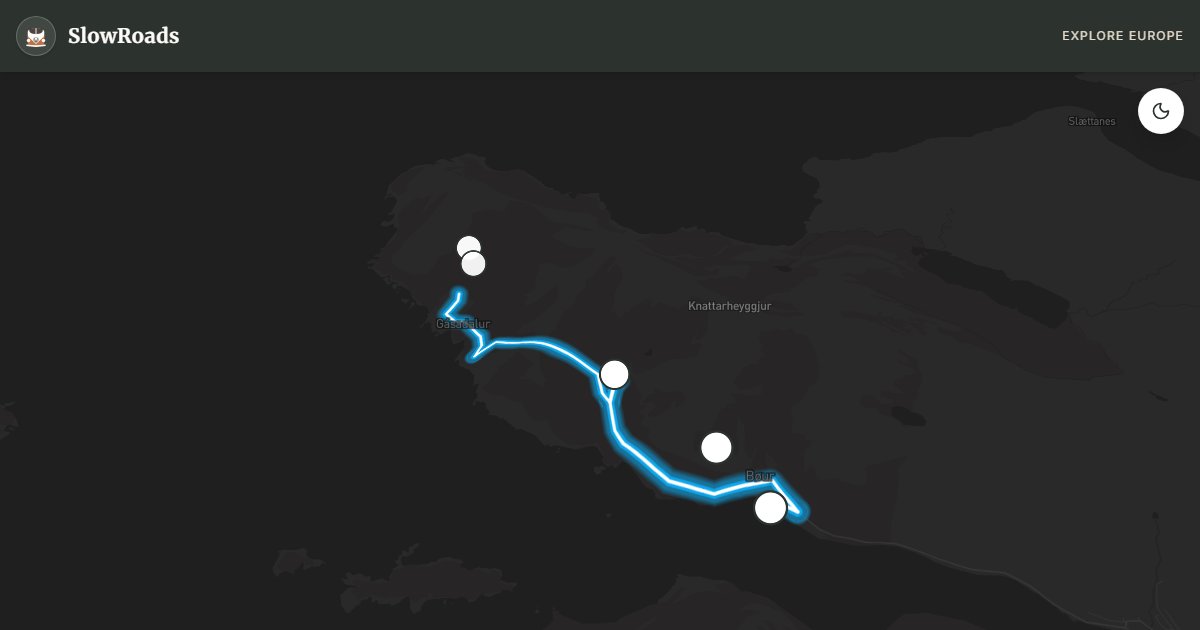
Gásadalur and Múlafossur is the Faroe Islands' postcard — a waterfall that plunges directly from a sea cliff into the North Atlantic, above a village so isolated it was reachable only by a dangerous mountain path until a tunnel opened in 2004. For slow van travellers, this 7-kilometre detour from the Vágar main road is the archipelago's most concentrated scenic reward, but it demands tunnel etiquette, wind awareness, and realistic parking expectations.
The approach from Bøur village offers Tindhólmur sea stack views — five basalt peaks rising from the ocean that appear on every Faroes tourism image. Bøur itself is worth a pause: turf-roof houses, a church, and the last comfortable parking before Gásadalur's limited lot. The Gásadalur tunnel is single-lane with traffic lights at each end — wait for green, headlights on, and pull into passing bays if you encounter oncoming traffic mid-tunnel. The tunnel replaced a postman's path that claimed lives in winter storms; treat the access with respect.
Gásadalur village parking is a single small lot that fills by mid-morning in summer — arrive before 9 AM or after 5 PM for a campervan-sized space. Do not park on the cliff approach road or in passing bays. Múlafossur is a five-minute walk from the lot along a cliff-edge path where Atlantic gusts regularly exceed 25 m/s — secure van doors (they can blow open or slam shut), hold children firmly, and never approach the unfenced cliff edge in high wind.
For classic and low-power campervan drivers, the route is mechanically easy — no steep grades, short distance — but weather governs the experience. The cliff path closes informally in storm warnings; fog eliminates the dramatic backdrop that makes the photograph work. Visit at sunrise or sunset for golden light on the waterfall. No camping at Gásadalur — return to Miðvágur or Tórshavn for overnight. Pair with the main islands loop and the Vágar airport approach for a complete western Faroes day.
Arrive before 9 or after 17 for a van-sized space in Gásadalur’s small lot — no overnight parking. Wait for green at the single-lane tunnel lights; do not enter on red. Secure van doors in cliff wind; skip the unfenced path above ~15 m/s gusts. No camping in the village — return to Miðvágur or Tórshavn. Classic campervans face zero grades; weather and parking are the constraints. Pair with the main islands loop on Vágar.
The Gásadalur road and tunnel access transformed a once-isolated hamlet; still expect single-track patience and Atlantic spray near Múlafossur. Park in signed areas and walk to the waterfall viewpoint — do not block farm access. Weather can sock in the cliffs within minutes; carry layers even in July. Classic and low-power campervans handle the grades; wind on the approach is the limiter. Pair with the main islands loop the same day only if forecasts are calm. Midday tour buses compress the hamlet — dawn or late evening gives Múlafossur space. Do not drone without checking local rules; cliffs and nesting birds make this a sensitive stop for slow travellers who want to keep access open.
Frequently Asked Questions
Points of Interest
Bøur Village Viewpoint
Town
A classic Vágar village with turf houses and Tindhólmur islet views — stop before the Gásadalur tunnel.
Gásadalur Tunnel
Monument
A 1.4 km single-lane tunnel blasted through the mountain — replaced the old postman's path over the pass.
Múlafossur Waterfall
Nature
The waterfall plunging directly into the North Atlantic from a sea cliff — the Faroes' most photographed scene.
Gásadalur Village
Town
An isolated village of fewer than twenty residents — grass roofs, silence, and Atlantic horizon.
Tindhólmur Sea Stacks
Nature
Dramatic sea stacks visible from Bøur and Gásadalur — five peaks rising from the ocean.
Route Highlights
Route Information
Navigation
* Supported by HERE Technologies, headquartered in Amsterdam, Europe. Precise routing through all waypoints.
* Waze only navigates to the starting point. Use Google Maps for the full scenic route.
Offline GPS Navigation
Download the GPX route file to navigate offline using your favorite GPS device or app (Garmin, TomTom, OsmAnd, Gaia GPS).