About This Route
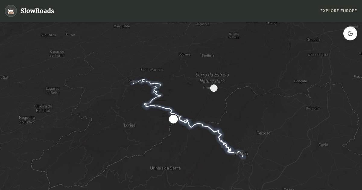
Climb mainland Portugal's highest road to Torre (1,993 m) from Covilhã toward Seia — granite boulders, glacial lagoons, and sustained 8–12% grades for classic campervans. Expect cooling stops, low gears, and winter chain or closure risk December–March. Spring heather and autumn clarity beat August crowds on the plateau. Overnight outside the natural park's protected core: use campsites at Manteigas, Covilhã, or Unhais da Serra — not wild pulls beside the summit antennas. Fill fuel in the valleys before the long climb.
Detailed Route Guide
The Serra da Estrela — the Star Mountain — is one of Iberia's most dramatic and least-visited highland landscapes. Reaching 1,993 metres at Torre, this massif forms the spine of central Portugal and is mainland Portugal's most reliable winter-snow destination (home to the country's only ski resort). The road from Covilhã to Seia crosses the plateau, climbing from the textile town of Covilhã through pine and heath into a boulder-strewn lunar highland. Enormous rounded granite blocks — some house-sized — lie scattered from Ice Age glaciation. Glacial valleys (covões) cut deep into the flanks, and Lagoa Comprida shimmers at altitude in grey-blue tones under changing skies.
Serra da Estrela Natural Park, established in 1976, is Portugal's largest protected area. Lusitanian tribes settled these heights before Rome; for centuries shepherds used the plateau for summer grazing (transhumance). Dry-stone abrigos still dot the heath. Manteigas, in the glacial valley below the main ridge, is the natural hub and produces Queijo da Serra — a creamy DOP sheep's cheese among Portugal's culinary treasures. Pair it with mountain bread and local aguardente for a van-side picnic at altitude.
For classic and low-power campervan drivers, this route demands respect. The climb from Covilhã to Torre involves sustained gradients of roughly 8–12% with hairpins, and total elevation gain exceeds 1,600 metres. An underpowered or poorly maintained engine will struggle, especially in summer heat. Check coolant and oil before departure; stay in low gears on the climb; cool the engine at the summit before descending; and engine-brake on long downhills to spare the brakes. The reward is infinite plateau views and the surprise of genuine high-altitude wilderness in Portugal. The western descent toward Seia is gentler than the eastern climb. Prefer campsites in Manteigas, Unhais da Serra, Linhares da Beira, or Covilhã — overnighting as wild camping inside the protected park is not allowed.
Winter (December–March) often brings snow to Torre; the access road may close or require chains — check with the municipality or GNR before leaving. Spring (April–June) brings heather bloom and meltwater cascades. Summer is most accessible but busiest on August weekends. Autumn is often finest: clear bright days, golden heath, and quiet weekday mornings.
Allow a full day for the crossing if your van is modestly powered: the climb itself may take longer than the map suggests once you factor cooling stops, photo pull-offs at Penhas da Saúde, and the temptation to walk short trails around Torre and Lagoa Comprida. Carry water and a warm layer even in summer — the plateau can be windy and 10°C cooler than Covilhã. If snow is forecast, have a lowland Plan B (Seia or Manteigas valley roads) rather than forcing chains on an unfamiliar summit approach.
From Torre on a clear day you can read the Beira interior as a map of ridges and reservoirs; on cloudy days the plateau feels closed-in and alpine despite the modest absolute altitude. Watch for cyclists on summer weekends — many ride the same climb — and give them room on blind hairpins. If your classic camper runs hot, consider ascending early morning from Covilhã, spending midday walking near the summit facilities, then descending toward Seia in cooler air with rested brakes.
Frequently Asked Questions
Points of Interest
Torre Summit (1,993 m)
Nature
Manteigas Glacial Valley
Nature
Route Highlights
Nearby Scenic Drives
Route Information
Navigation
* Supported by HERE Technologies, headquartered in Amsterdam, Europe. Precise routing through all waypoints.
* Waze only navigates to the starting point. Use Google Maps for the full scenic route.
Offline GPS Navigation
Download the GPX route file to navigate offline using your favorite GPS device or app (Garmin, TomTom, OsmAnd, Gaia GPS).
Ask Copilot (AI Travel Guide)
Hello! I am your SlowRoads Copilot. I know the Serra da Estrela Mountain Pass intimately. Ask me about scenic viewpoints, local history, hidden culinary gems, or the best camper spots along the way!