About This Route
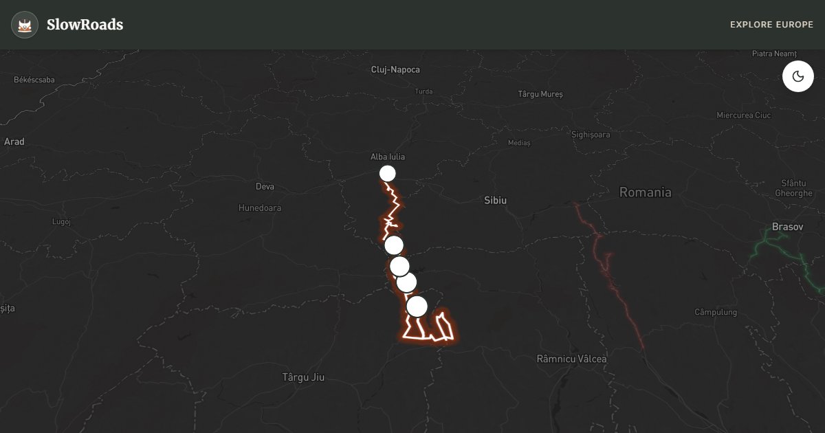
Romania's highest paved road — DN67C crosses the Parâng Mountains at Urdele Pass (2,145 m), wilder and often quieter than the Transfăgărășan with sweeping ridge-top driving. Steep sustained climbs, rough summit sections, and seasonal closure outside roughly late May/June–October demand CNAIR checks. Classic and low-power campervan drivers should monitor engine temperature closely, climb in cool hours, and fill fuel in Novaci and Sebeș before the high miles. Allow a full day; treat the ridge as the destination, not a shortcut between valleys.
Detailed Route Guide
The Transalpina — DN67C — is the road the Transfăgărășan doesn't want you to know about. While its famous cousin draws international traffic and television crews, the Transalpina crosses the Parâng Mountains at Urdele Pass, 2,145 metres above sea level, making it the highest paved road in Romania and one of the highest in the entire Carpathian arc. Originally a shepherd's trail upgraded over centuries and fully paved only in the early 2010s, the Transalpina offers something increasingly rare in European alpine driving: long stretches of ridge-top road where the tarmac runs along the crest of the mountains with views dropping away on both sides, and traffic that remains manageable even in peak summer.
The classic drive runs from Novaci in Oltenia, climbing through the Rânca resort area where sheep still graze beside ski lifts shuttered for summer, before the road opens onto the high plateau near Urdele Pass. Here the landscape transforms — no trees, just grass, rock, and sky. The summit section can feel like driving along the roof of Romania. Clouds form and dissolve around you; the Parâng range extends south toward the Danube and north toward Transylvania in a single panoramic sweep. Unlike the Transfăgărășan's relentless hairpins, the Transalpina's challenge is less about switchbacks and more about sustained high-altitude climbing and occasionally rough surface quality near the summit where winter damage is repaired each spring.
For classic and low-power campervans, the Transalpina is a serious but achievable undertaking. Gradients on the southern approach from Novaci are long and steady rather than brutally sharp, but the altitude and sustained climbing still stress air-cooled engines. The northern descent toward Sebeș drops through the Lotru valley in forest shade — easier on the cooling system going up, demanding on the brakes going down. Carry coolant, check your brakes before attempting the pass, and plan to climb in the cool morning hours. The road is typically open June through October, subject to the same snow-gate closures as other Romanian high passes; verify status with CNAIR before setting out.
The Transalpina rewards slow travel with solitude. Stop at Urdele Pass for photographs that need no filter, pause in Obârșia Lotrului for a coffee at one of the few high-altitude settlements, and descend into Sebeș for a Transylvanian dinner before finding a campsite or guesthouse parking spot. Fuel in Novaci before ascending and in Sebeș after — nothing exists on the ridge itself. Two days allows a relaxed pace with an overnight near Rânca or Obârșia Lotrului; one long day is possible for experienced drivers who start at dawn.
Verify DN67C status with CNAIR before you leave Novaci — ridge snow and spring repairs can close the summit without warning. Rânca offers a useful cool-down and coffee stop on the southern climb; Obârșia Lotrului is a sparse high settlement, not a full service hub. Classic and low-power campervans that respect altitude, coolant, and solitude will prefer Transalpina's emptier ridge to Transfăgărășan's coach queues.
Sebeș at the northern end returns you to Transylvanian services — fuel, food, and a Saxon-town evening after the ridge. If weather turns on Urdele, descend rather than wait exposed at 2,145 m in a loaded older camper. Transalpina's gift is emptiness; keep it by starting early and leaving the summit before afternoon cloud builds.
Frequently Asked Questions
Points of Interest
Rânca Ski Resort
Town
A mountain resort village on the southern ascent with cafés and summer pasture views.
Urdele Pass Summit
Nature
The highest point of DN67C at 2,145 metres — open ridge driving with vast Parâng panoramas.
Obârșia Lotrului
Town
A high-altitude settlement on the northern descent with a small church and mountain meadows.
Lotru River Valley
Nature
Deep forested valley below the pass where the road drops through ancient spruce woodland.
Sebeș Old Town
Town
Transylvanian market town at the northern end with Saxon-era architecture and fuel stations.
Route Highlights
Route Information
Navigation
* Supported by HERE Technologies, headquartered in Amsterdam, Europe. Precise routing through all waypoints.
* Waze only navigates to the starting point. Use Google Maps for the full scenic route.
Offline GPS Navigation
Download the GPX route file to navigate offline using your favorite GPS device or app (Garmin, TomTom, OsmAnd, Gaia GPS).
Ask Copilot (AI Travel Guide)
Hello! I am your SlowRoads Copilot. I know the Transalpina Pass (DN67C) intimately. Ask me about scenic viewpoints, local history, hidden culinary gems, or the best camper spots along the way!